It won’t be long before we start consistently seeing cooler morning lows. Here’s the timeline.
SAN ANTONIO — Fall has arrived to San Antonio, and although leaves on our trees are greener than in other states further north, we don’t have to wait long for signs that the holiday season is right around the corner.
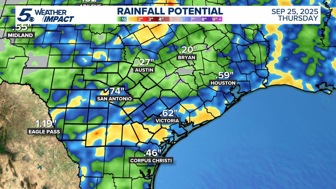
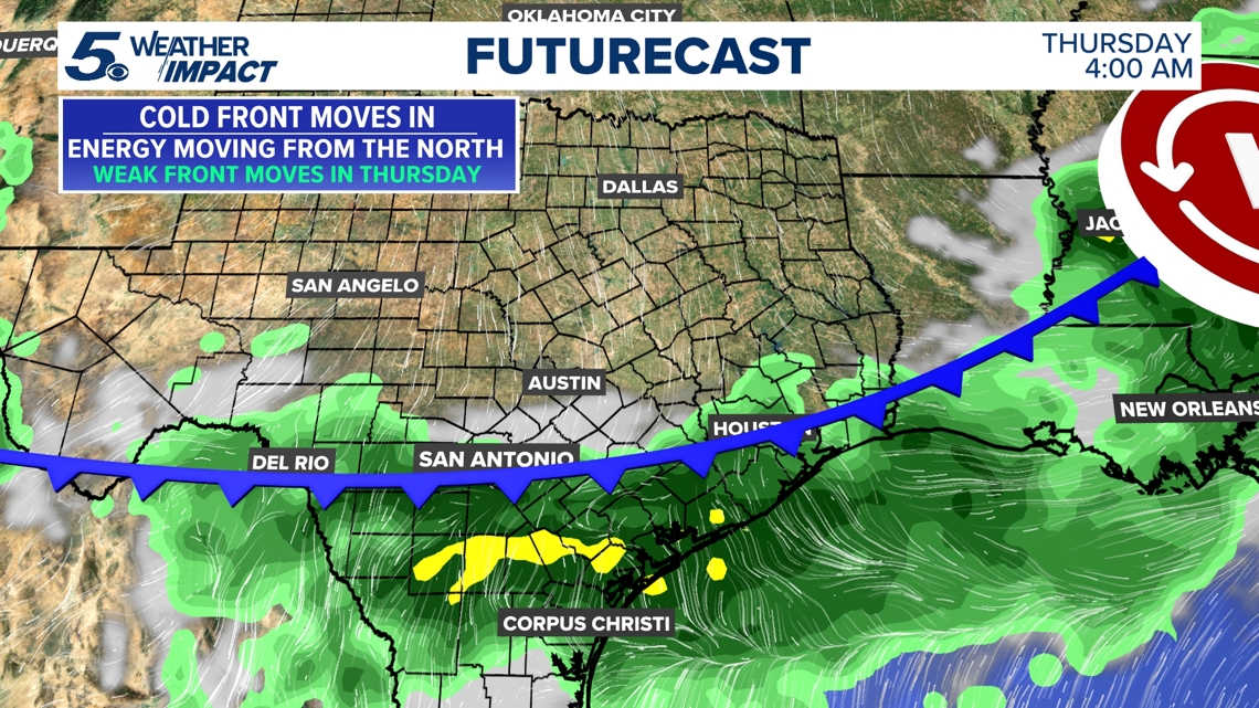
After a stretch of mornings that mostly didn’t see the mercury dipping under 70 degrees, the Alamo City is in for cooler mornings when a weak cold front pushes through the area Thursday morning. It brings a chance of mostly scattered showers and isolated thunderstorms to our region, as well as a taste of fall with some days expected to begin in the 60s.

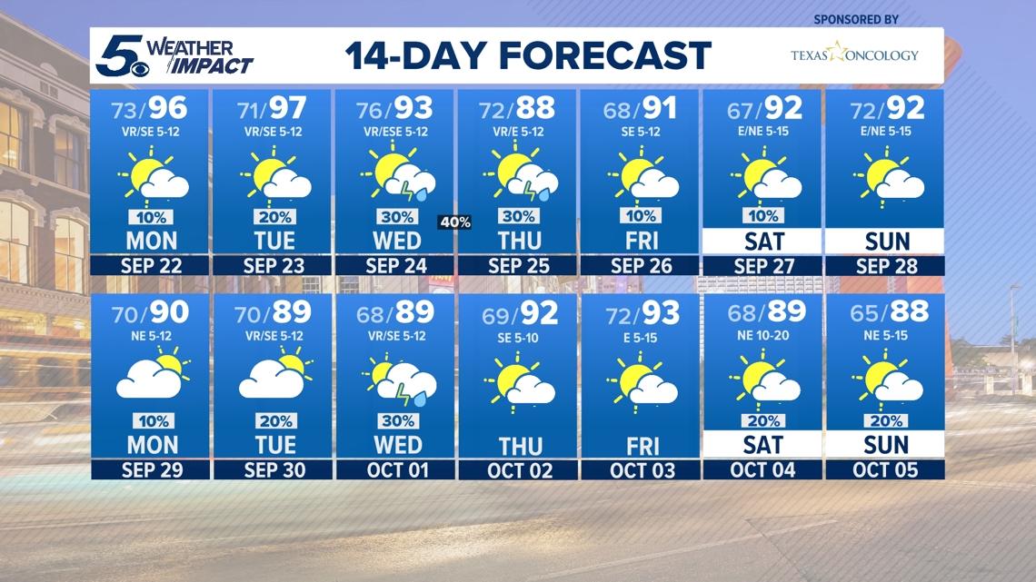
As we get closer to October, afternoon highs are starting to cool off as well. Daytime highs will be close to average in the upper-80s for a day or two before a quick rebound by the weekend with the mercury expected to return to the lower-90s.
Looking ahead to next week and the start of the year’s spookiest month, however, and those days of morning lows in the 60s and afternoon highs in the 80s are expected to become more frequent.
Historically, on average the daily highs in San Antonio go from 90.1 degrees in September to 82.2 in October, while morning lows drop from 69.6 to 60.4, according to National Weather Service data.

Some Hill Country towns won’t have to wait until October for the brisk air to arrive. Fredericksburg could see morning lows in the high 50s later this week, while Kerrville, Llano and Rocksprings will all see the mercury hovering in the low-to-mid-60s by the weekend.
Here’s a look at what’s expected in San Antonio the rest of this week and beyond.
Monday night: Low of 76. Partly cloudy conditions, with temperatures dropping into the mid-70s after threatening to reach triple-digits in the afternoon. Southeasterly winds reaching 10 mph.
Tuesday: Low 76, high 97. Afternoon temps threaten to reach 100 degrees against, with heat index values shooting as high as 106. Wind gusts could reach 20 mph under mostly cloudy skies that clear out after sundown.
Wednesday: Low 78, high 96. Chance of showers arrives to San Antonio, along with the potential for an afternoon thunderstorm or two. 60% chance of rain.
Thursday: Low 70, high 87. You might start to feel more bearable temperatures in the afternoon as the cold front sweeps through San Antonio. 40% chance of showers as the mercury dips, with calm winds at night.
Friday: Low 66, high 90. It’ll be a great day for a morning stroll as we get a taste of fall early in the day. Mostly sunny to end the week, with north-northeasterly winds of around 5 p.m.
Saturday: Low 67, high 91.
Sunday: Low 68, high 91.