Stay updated with the KENS 5 Weather Team on this severe weather development and how it impacts you.
BEXAR COUNTY, Texas — Impact Day: Thursday, Dec. 4
Reason: A cold front bringing windy conditions and scattered rain, with isolated downpours.
The breakdown
The final month of 2025 has gotten off to a cooler-than-usual start in San Antonio, with the mercury stalling out in the mid-50s Monday and Tuesday—a good 10 degrees below the historical average high for the Alamo City in December.
That’ll change Wednesday with a very brief and mild recovery in temperatures putting us back above 60 degrees. Areas south and west of the Alamo City will see temps near 70 that afternoon.
But the warm recovery won’t last long—another round of colder air arrives Thursday morning after a mix of sunshine and clouds Wednesday. As cold dense air sinks, warm humid air will overrun across South Texas thanks to the incoming cold front.
You’ll also want to make sure you hold onto your umbrella Thursday: Winds will be gusting between 25 mph and 35 mph.
The front will drop temperatures and result in scattered rain Thursday and Friday. The precipitation will consist of mostly light activity, with only isolated pockets of heavy rain.

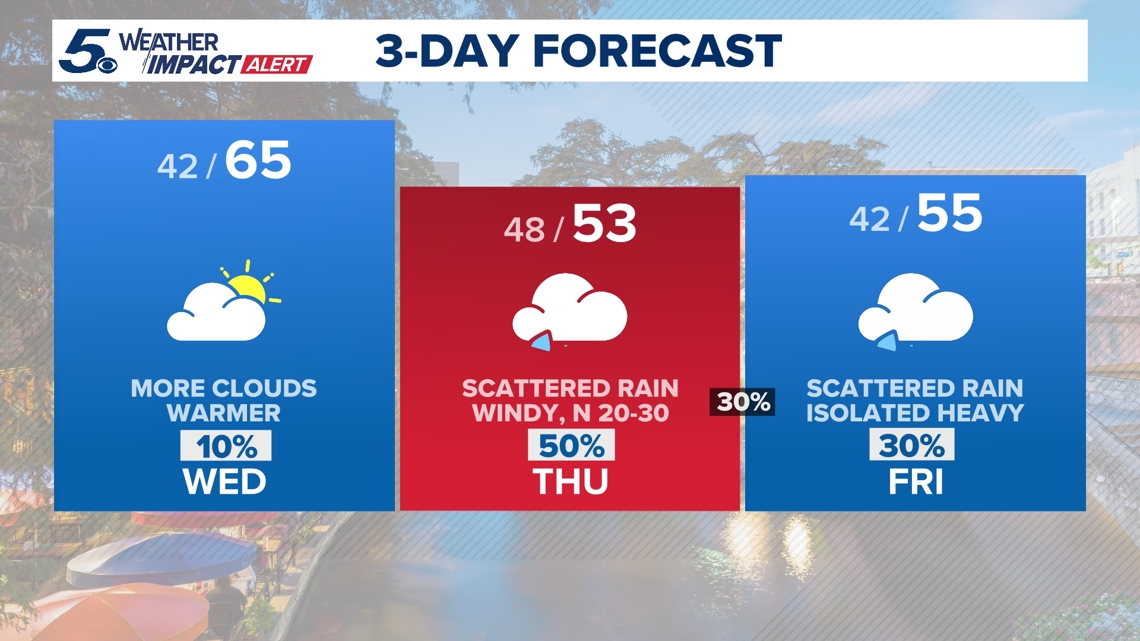


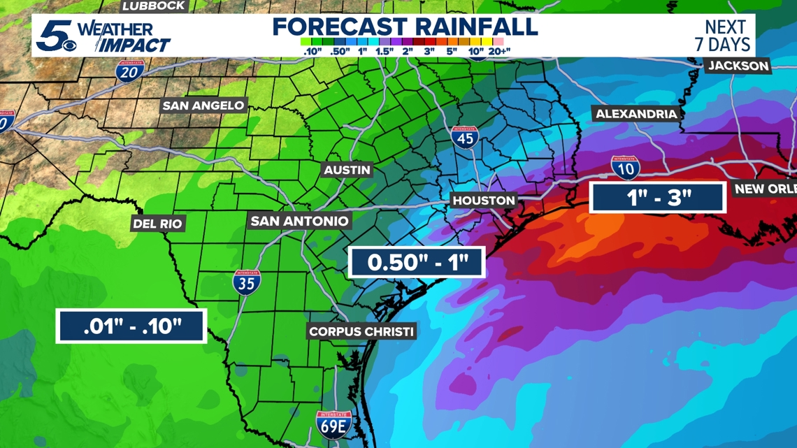
Our region is expected to see only between a tenth of an inch and a quarter of an inch, on the higher side. Again, it’ll mostly be a cold, on-and-off light rain. San Antonio typically receives two inches of rain in an average December, but November was usually dry as the Alamo City received less than half an inch of rain.
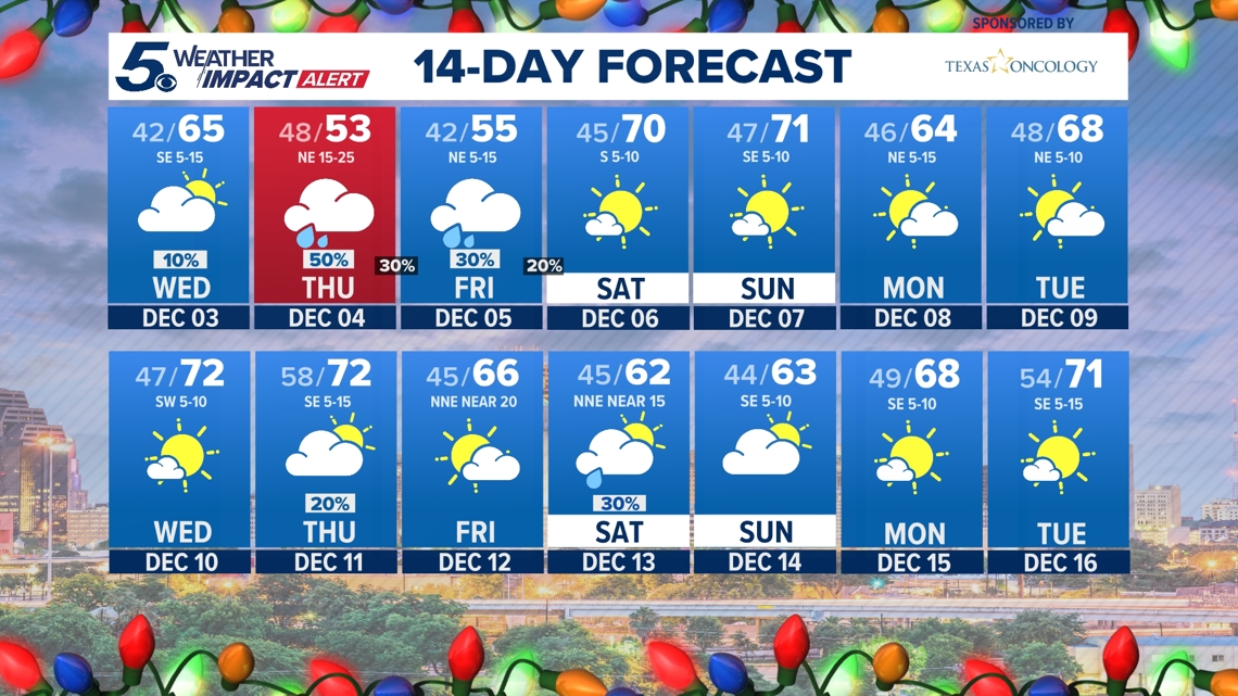
By the weekend, skies will gradually clear. Morning lows will stay cold in the 40s with daytime highs in the lower 70s on Saturday and Sunday.
And expect a warming trend as we head into the start of next week. Daytime highs will be closer to the 70s with lows in the 40s and 50s.

Looking ahead

This is a developing weather event. Refresh the page for the latest updates.