The National Weather Service warned of a moderate risk of isolated flooding.
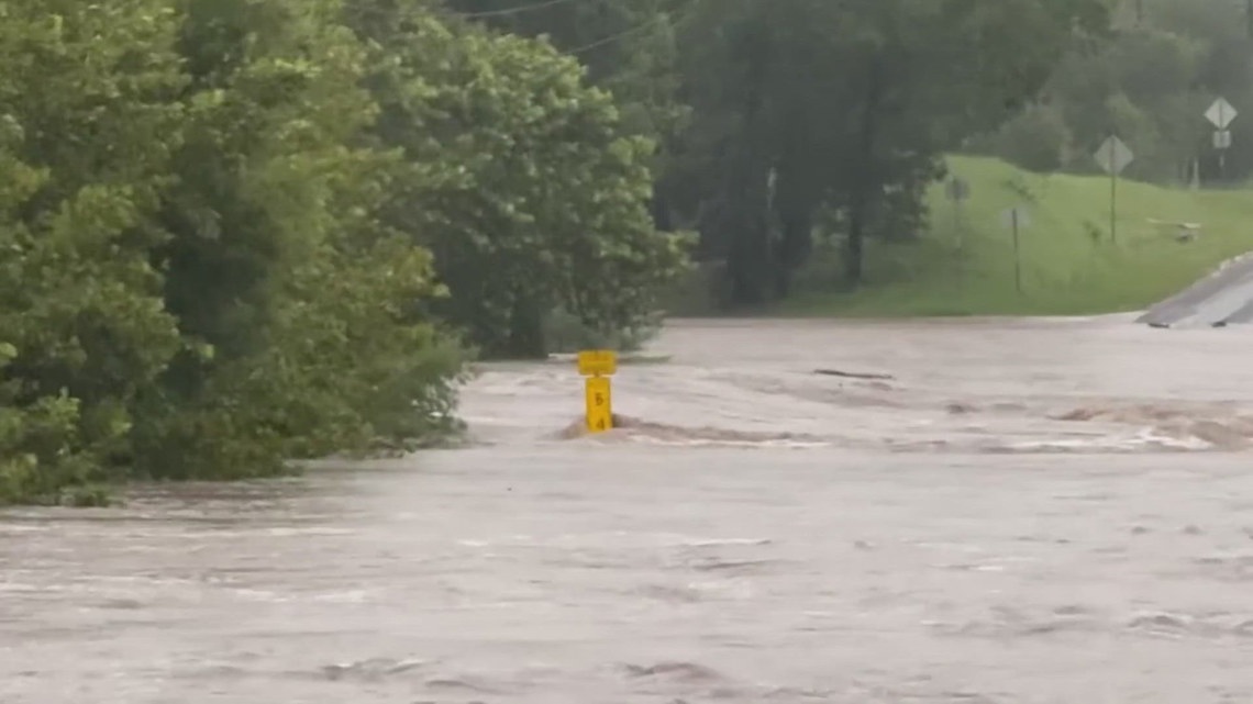
SAN ANTONIO — As search and recovery efforts continue following the deadly Fourth of July floods, flooding affected parts of the Hill Country and Frio Canyon.
The National Weather Service had issued flood warnings Monday for parts of Kerr, Bandera, Uvalde and other counties. The Frio River crested at more than 16 feet above normal, which is flood stage.
In a Facebook post, the Kerr County Sheriff’s Office urged volunteers to get to higher ground as new storms arrived early Monday afternoon:
“Due to the incoming threatening weather, all volunteers should vacate the river area, and MOVE TO HIGHER GROUND for their safety. Only teams working under the direction of Kerr County Emergency Operations Center Unified Command are permitted in the response zone.
Around 1 p.m., the National Weather Service said the storm system leading to the flooding was weakening.
Temperatures over the next several days will continue to be below average to average in the low to mid 90’s, due to soil moisture levels.
Past Monday morning there is a 20% chance of an afternoon thundershower Monday afternoon and a 10% chance Tuesday afternoon.
Next week highs should be in the mid 90s.
Saharan dust should make a comeback for July 16 and July 17.
The NWS says you should take these three steps to stay safe during a flood:
- Get to higher ground and out of areas subject to flooding
- Don’t drive or walk into flooded areas as it only takes six inches of water to know someone off their feet
- Stay informed by monitoring local radar, television, weather radio, internet or social media for updates
This is a developing weather event. Refresh the page for the latest updates.