The Hill Country is also under an Ice Storm Warning through Sunday morning, with a half-inch of accumulation possible in some areas. Here’s the latest.
BEXAR COUNTY, Texas — IMPACT DAYS: Sunday, Jan. 25 through Tuesday morning, Jan. 27
Reason: Modified arctic air with freezing rain and ice accumulation.
The breakdown
An Extreme Cold Warning is in effect through Monday morning for all of South-Central Texas, including San Antonio. Some areas could see wind chills in the single digits, mainly in northern Bexar County and the Hill Country.
A Winter Storm Warning expired around noon Sunday as temperatures rise across the area and ice accumulation begins to melt.
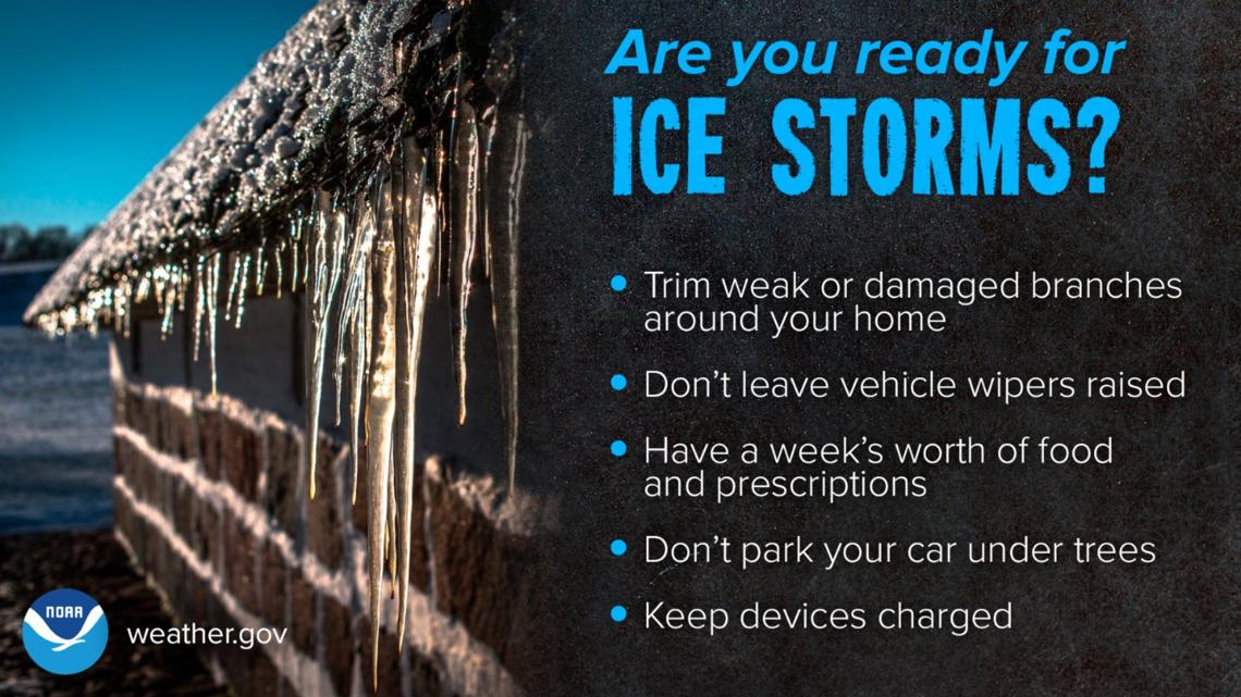
The National Weather Service had also placed some counties under an Ice Storm Warning. This includes the following counties in the KENS 5 viewing area: Edwards, Real, Kerr, Bandera, Gillespie, Kendall, Blanco and Comal.
Significant icing is expected in those communities, with ice accumulations of a quarter-inch possible and even up to half inch, with isolated totals of 1/2 inch are possible. In addition, dangerously cold temperatures are expected through Monday morning. Roads, and especially bridges and overpasses, will likely become slick and hazardous, making travel nearly impossible. Weather-related power outages and tree damage are possible due to the ice.
There is also a chance for less than a half inch of ice accumulation on elevated surfaces in Bexar County, south of Loop 1604 and along Interstate 10/Highway 90.
On Sunday, more light freezing drizzle is possible in the morning. We’ll stay cloudy as highs reach the mid-30s.
The coldest temperatures, meanwhile, arrive Monday and Tuesday, with morning lows possibly in the upper-teens before getting no warmer than the upper-30s Monday. Tuesday will be a little warmer, with highs reaching the mid-to-upper-40s.
Preparing for the cold
NWS says Texas residents should monitor the forecast frequently as changes are possible and prepare now for winter weather impacts.
The Electric Reliability Council of Texas (ERCOT) says it is monitoring the cold weather and will keep Texans informed on grid conditions. ERCOT officials have said the state’s power grid is prepared to handle winter weather.
NWS reminds residents extreme cold could become life threatening and likely damage unprotected pipes and put livestock at risk if precautions are not taken. Dress in layers including a hat, face mask and gloves if you must go outside.

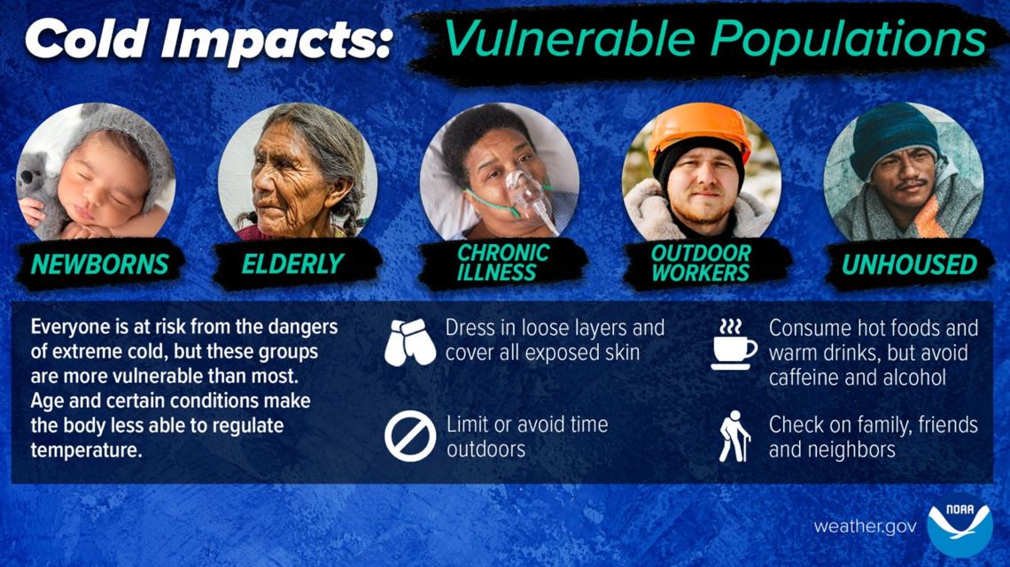

Don’t forget your pets! NWS urges pet owners to make sure to give proper care to our four-legged friends to ensure they have a safe space that is warm and dry during the winter storm.
This is a developing weather event. Refresh the page for the latest updates.