Stay updated with the KENS 5 Weather Team on this severe weather development and how it impacts you.
SAN ANTONIO — IMPACT DAYS: Thursday, June 12
Reason: Heavy rain is possible with localized flooding, severe thunderstorms with hail up to the size of quarters and wind gusts up to 60 mph.
The breakdown
Two weeks after San Antonio’s wettest stretch of the year, storm clouds are gathering and letting loose over the region once again.
The stage was set for multiple rounds of showers and storms to sweep through South Texas through Thursday, bringing potentially damaging wind gusts and hail to the area, according to the National Weather Service. Thunder rumbled over the Alamo City early Wednesday morning, and parts of town saw between half an inch and eight-tenths of an inch of rain.
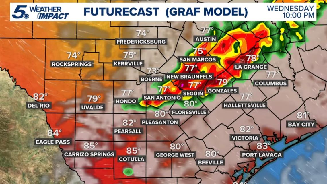
Now an even stronger round of rain is approaching Wednesday evening, and a Flash Flood Warning is in effect for parts of Bexar, Comal and Guadalupe counties until 5 a.m. Thursday. A Tornado Warning briefly in effect for Leon Valley, Helotes and parts of west San Antonio expired at 12:15 a.m.; we likely won’t know until Thursday if a twister officially touched down.
CPS Energy outages were minimal at 1 a.m. Thursday, with just under 1,600 customers without power. See the Outage Map here.
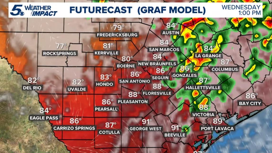
A Flood Watch is also expected to remain in place for San Antonio and communities along the Interstate 35 corridor until 7 p.m. Thursday. According to the National Weather Service, rainfall amounts of 2 to 4 inches are expected over the next 24 hours, with isolated amounts of 6 inches possible in some areas.
Day-by-day forecast
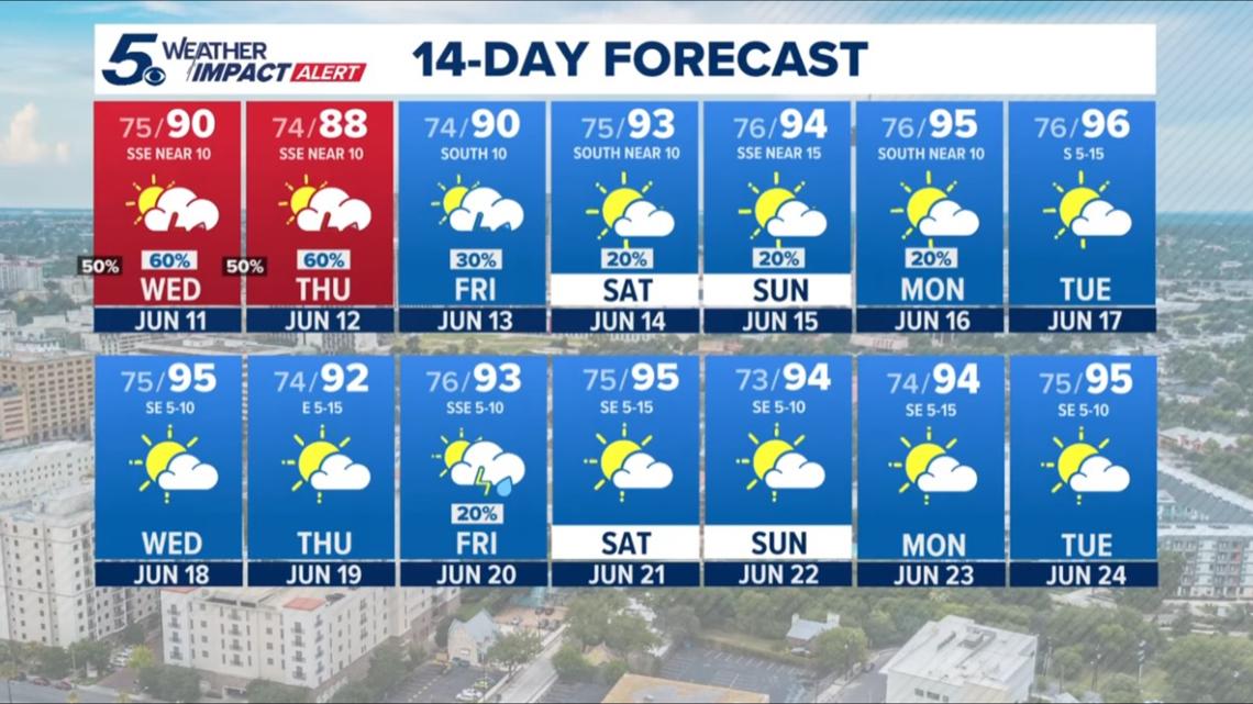
Wednesday: Low 76, high 90. Morning showers likely for the Wednesday morning commute, with rain chances lingering through the afternoon. Storm chances return in the late afternoon; mostly cloudy all day. 60% chance of rain.


Thursday: Low 74, high 93 degrees. Slight chance of morning showers, with storm chances returning in the afternoon, including a potential for heavy rainfall. 60% chance of rain.
Friday: Low 76, high 93. Small chance of early showers evolves into a chance for thunderstorms after 10 a.m. Partly sunny skies, with wind gusts reaching 20 mph. 30% chance of rain.
Saturday: Low 76, high 94. Partly sunny skies to start the weekend, accompanied by a 20% chance of showers and storms in the afternoon.
Looking ahead…

This is a developing weather event. Refresh the page for the latest updates.