Stay updated with the KENS 5 Weather Team on this severe weather development and how it impacts you.
BEXAR COUNTY, Texas — Weather Impact Alert Day: Sunday, Sept. 7, 2025
The reason: Marginal risk for flooding, some downpours could be heavy
The breakdown
The heaviest rain activity Sunday is expected over the Rio Grande and the Hill Country. Rainfall of 2 to 3 inches per hour are possible, and in some spots totals could reach up to 5 inches.
Localized flash flooding remains a concern in our viewing area.
A Flood Advisory is in effect for Bexar County which includes Alamo Heights, Terrell Hills, and Timberwood Park until 3:15 p.m.
Please avoid low-water crossings and flood-prone areas.
The National Weather Service says moderate to locally heavy rain continues to affect much of the region. Rain could be enough to result in minor nuisance flooding and/or ponding on area roadways.
CPS Energy says there are nine active power outages impacting 1,352 customers at this time.
We’re expecting temperatures seven to eight degrees above seasonal average. There will be a slight drop in humidity in South Texas, which will help the mercury climb into the triple-digits.
Scattered showers and thunderstorms are expected Sunday through this evening. Locally heavy rains are possible and may cause flooding. Due to the clouds and rain, high temperatures will be 5 to 11 degrees below average for September 7.

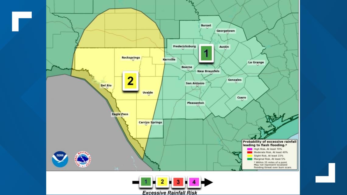
That forecast and risk area map could change further on Sunday.
Day-by-day forecast
Sunday: Low 76, high 89. As the mercury dips, the rain chances rise to end the weekend. There’s a 60% chance of rain and possible storms which could bring flooding to parts of the region.
Monday: Low 74, high 88. A 10% chance of afternoon showers and storms.
This is a developing weather event. Refresh the page for the latest updates.