Stay updated with the KENS 5 Weather Team on this severe weather development and how it impacts you.
BEXAR COUNTY, Texas — IMPACT DAYS: Saturday, Aug. 16
Reason: Scattered heavy rain possible in San Antonio area.
The breakdown
A tropical disturbance in the Gulf is expected to spread scattered rainfall across South-Central Texas on Saturday.
The National Weather Service issued a Flood Watch for Real, Uvalde, Kerr, Bandera and Medina counties lasting until 7 p.m. Saturday.
NWS said they had “increasing confidence on a small-scale heavy rain event” with widespread 1 to 2 inch rains possible over the area with isolated stripes of 3 to 5 inch amounts possible. The watch area could be affected as early as 3 a.m. Saturday.
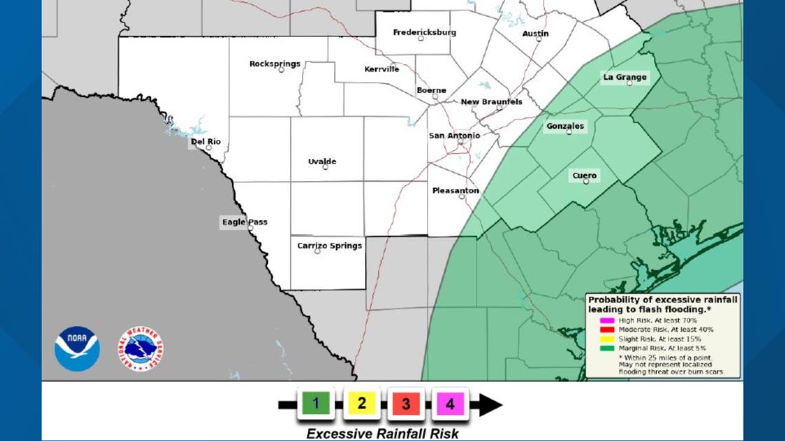
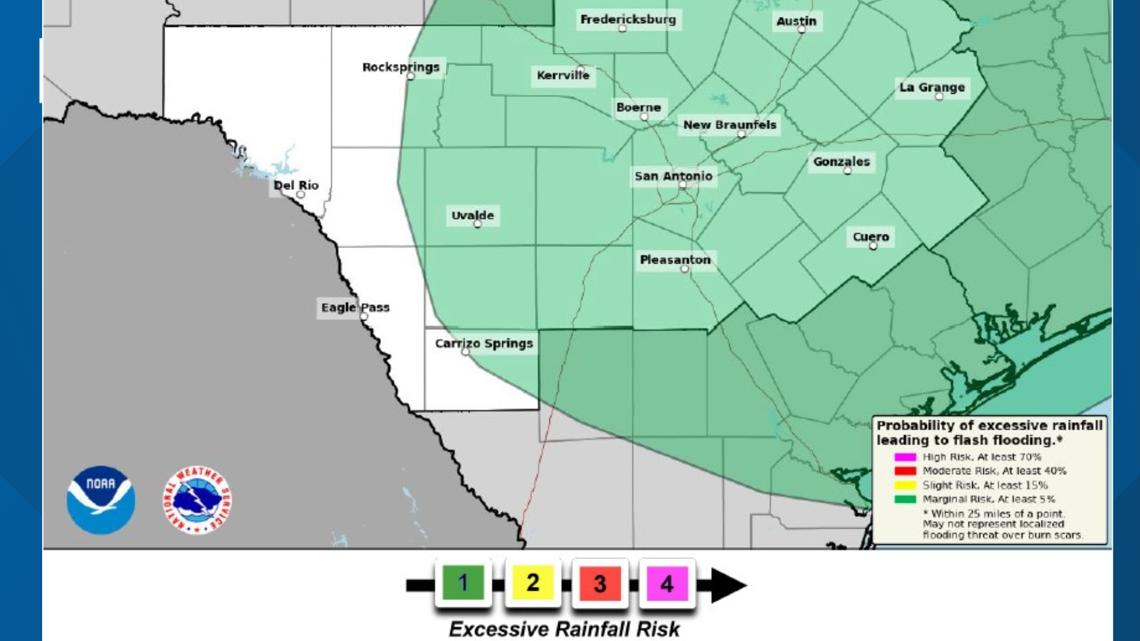
Much of the San Antonio region, including the Hill Country and communities along the Interstate 35 corridor, are under a Level 1 out of 4 risk for excessive rain Saturday, primarily between midnight and 8 p.m. Saturday, according to the National Weather Service.
Some areas could see up to 1 to 2 inches of rain, the NWS said.
Otherwise, afternoon highs will be near or slightly above average over the next couple of weeks, but heat index values – or the feels-like temperature – should stay near 100 to 104 degrees, which is below Heat Advisory criteria.
Some days may be close to Heat Advisory status, but at this time no impact days and no other days of interest.


Day-by-day forecast
Friday night: Low of 78 degrees. A 30% chance of showers and thunderstorms, wind gusts topping out at 20 mph.
Saturday: Low 78, high 97. Showers and thunderstorms possible, especially after 4 p.m., under mostly sunny skies. Heat index could reach 103 degrees. South-southeasterly winds between 5 and 10 mph, with gusts reaching 20 mph. 40% chance of precipitation.
Sunday: Low 78, high 100. We return to triple-digit heat under mostly sunny skies, winds calm to 5 mph.
Monday: Low 77, high 100. Another seasonably hot summer day in San Antonio, with partly cloudy skies. Calm winds at 5 mph.
Tuesday: Low 78, high 99. A 20% chance of afternoon showers and storms, but otherwise sunny and hot. Calm winds at 5 mph.
This is a developing weather event. Refresh the page for the latest updates.