Stay updated with the KENS 5 Weather Team on this severe weather development and how it impacts you.
BEXAR COUNTY, Texas —
Current alerts
The following alerts are currently in place from the National Weather Service:
- Tornado Watch remains in effect until 10 p.m. for Bandera, Edwards, Gillespie, Kerr, Kinney, Real, Uvalde and Val Verde counties in the KENS 5 viewing area.
- Severe Thunderstorm Watch in effect until 2 a.m. for Kendall County stretching north through Austin to Paris, Texas.
- Severe Thunderstorm Warning in effect until 9 p.m. for Kinney and Edwards counties. Half-dollar-sized hail and 60 mph wind gusts possible.
- Severe Thunderstorm Warning in effect until 9:15 p.m. for Val Verde County.
- Severe Thunderstorm Warning in effect until 9:15 p.m. for Blanco and Kendall counties.
Weather Impact Alert Days
Tuesday, March 10 and the morning hours of Wednesday, March 11
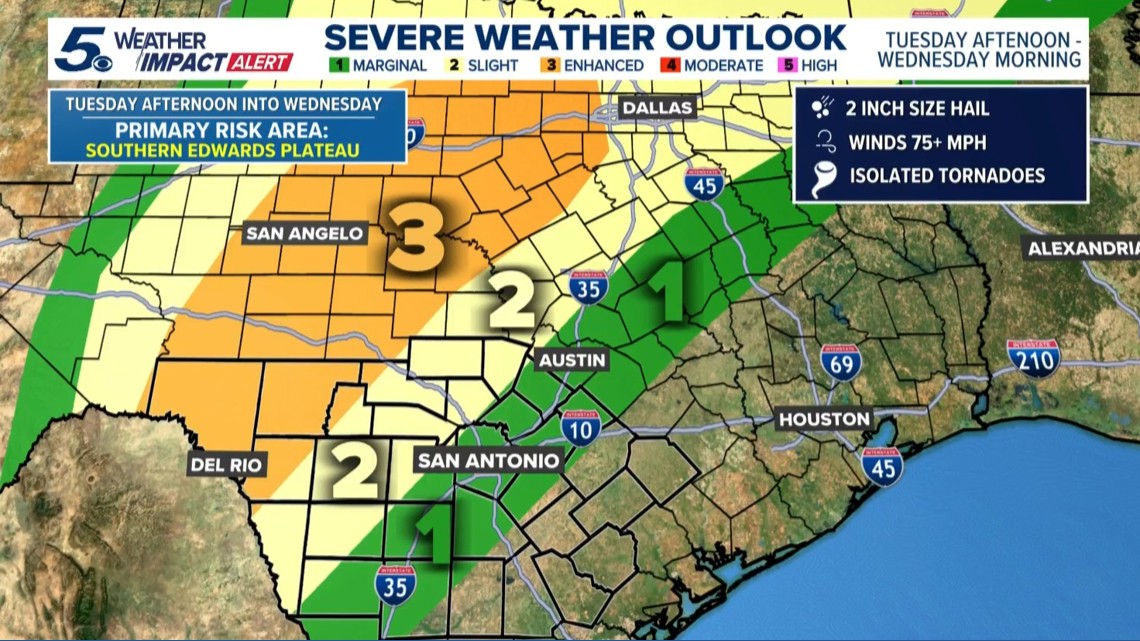
Reason: Chance for severe thunderstorms in the late evening, especially the western Hill Country communities. Possibility of two-inch hail, strong wind gusts and a possible tornado.
The breakdown
Severe storms are beginning to impact counties in West Texas as a weather threat brings the potential for large hail, damaging winds, and tornadoes to the Hill Country and South-Central Texas.
KENS 5 has received reports of baseball-sized hail in counties to the west, particularly in communities like Del Rio and Leakey.
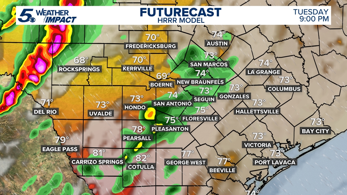
Monday’s warm temperatures set the stage for heavy rain, gusty winds, and hail across the region Tuesday afternoon and evening heading into Wednesday morning. The National Weather Service has issued a Tornado Watch for parts of Texas, including Uvalde and Kerrville, until 10 p.m.
The National Weather Service says storms impacting the Del Rio region around 5 p.m. are bringing tennis ball-sized hail and wind gusts of up to 80 mph.
Previewing the Tuesday storms
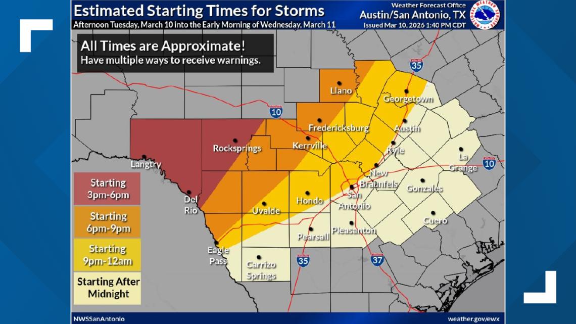
A cold front and upper-level disturbance is moving through the area from late Tuesday afternoon into Wednesday, bringing a line of showers and thunderstorms this evening through early Wednesday morning. Severe storms of all types are possible, especially across the Edwards Plateau and western Hill Country, where there’s an Enhanced Risk (Level 3 of 5).
Heavy rain could also cause localized flooding. As the system moves out, scattered storms — a few of them strong to severe — may develop along and east of the I-35 and I-37 corridors from midday through Wednesday evening.
While the tornado threat should decrease before the storms arrive to San Antonio, we are still expecting very loud thunderstorms and heavy rain. Most spots in the area will see between one and three inches of rain, which could result in localized flooding for the Wednesday morning commute.


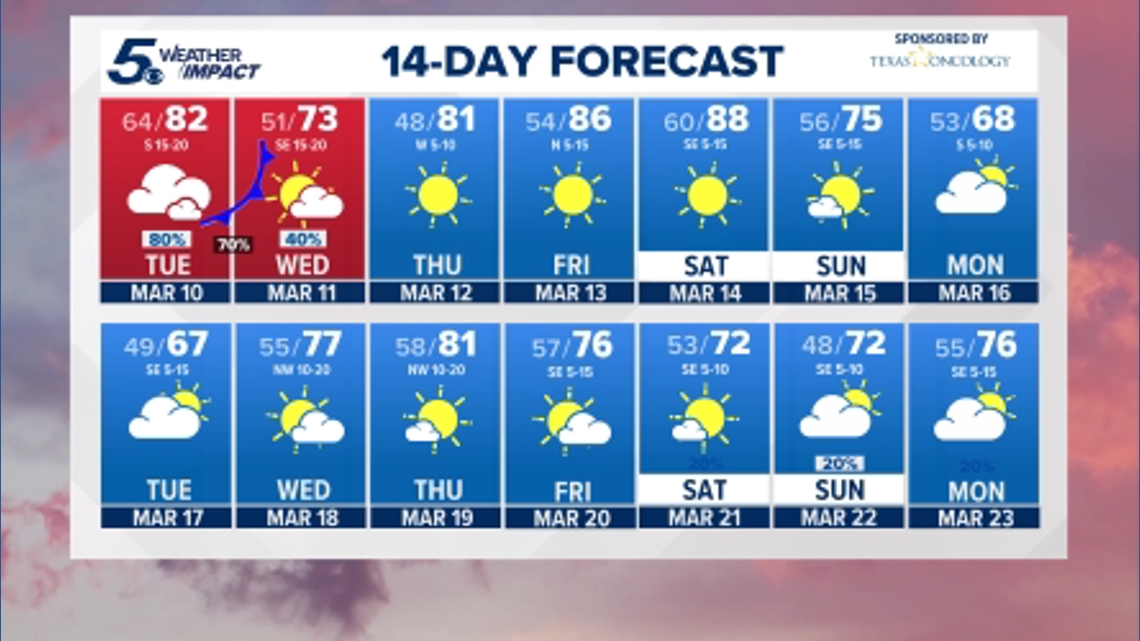
The good news is all things clears out by Wednesday afternoon. We’ll see much drier conditions for the second half of the week, leading into a sunny weekend expected to bring highs in the 80s.
Looking ahead

This is a developing weather event. Refresh the page for the latest updates.