The U.S. Geological Survey is on the frontlines before first responders to report water conditions that help inform them of future weather events.
SAN ANTONIO — Mike Nyman is the branch chief of the South Texas Program Office with the U.S. Geological Survey.
“Anytime there’s a big event like this, we are the ones responding immediately, because we’re watching it constantly,” Nyman said. “We’re following the flood pulse from San Antonio all the way to the coast.”
Saturday the group of scientists were measuring the San Antonio River in Floresville.
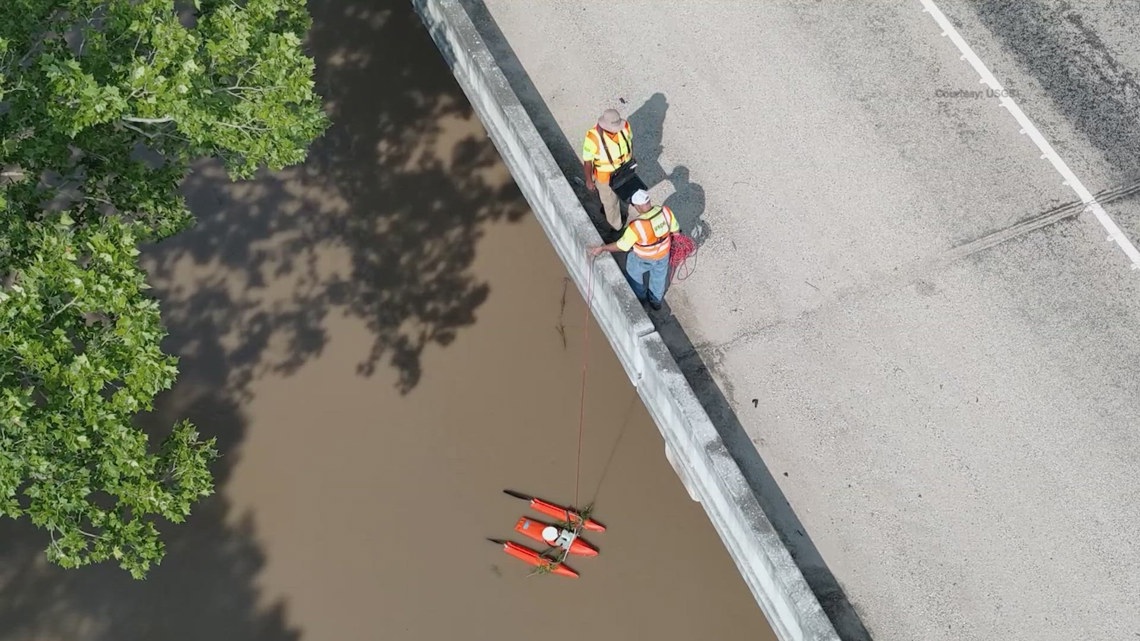
One of the tools the group uses is called an Acoustic Doppler Current Profiler (ADCP) which measures the velocity, depth and direction of the water.
“We started on a Thursday making measurements up in San Antonio and as the storm moved through, and the waters came up, we go through and we try to focus on getting high flow events.”
Nyman says that information is passed along to the national weather service, flood forecasters and emergency managers along with first responders.
The team also uses a drone to measure the speed of the water in the river.
“We measure how high the water gets and how fast it moves,” he said. “Because that affects the timing of when it’s going to get to the next community.”
Nyman says this information is crucial when coming up with evacuation tactics.
“Up in the hill country, up around San Antonio you have a lot of elevation change and so that water, when it hits the city it can’t absorb in the earth, so we call it impervious cover.” Nyman said. “Concrete and asphalt all that water moves off very quickly and moves downstream.”
One of the tools you can register for now – is the ‘National Water Dashboard’.
“If you live near a river, or where a gauge is, you can subscribe to this,” he said. “It’s called ‘WaterAlerts’. And WaterAlert will send you a text or email any time the water is coming up. If the water’s coming up quickly it’ll send you a text saying, ‘Hey, you should be aware of this.’”