Stay updated with the KENS 5 Weather Team on this severe weather development and how it impacts you.
BEXAR COUNTY, Texas — IMPACT DAYS: Monday, December 29
Reason: Cold temperatures and gusty wind.
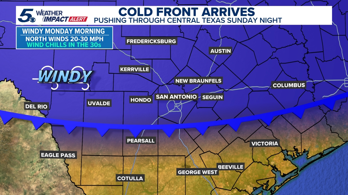
A strong cold front arrives just after midnight Sunday, bringing scattered overnight rain and isolated storms to south-central Texas.

The breakdown
A very strong cold air mass will spill southward through Texas, Sunday night – likely arriving to San Antonio just after midnight.
This will generate scattered rain and isolated storms overnight into pre-dawn, Monday.
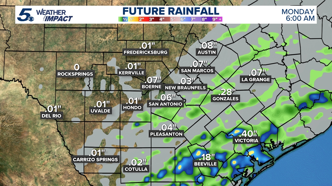
Rain totals stay light for most of us – about .10″ locally, with higher amounts southeast of the metro.

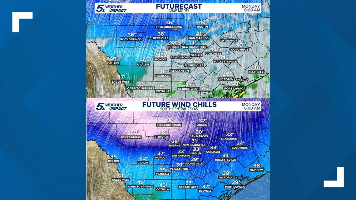
Winds pick up Monday morning, gusting near 35 mph. Wind chills drop below freezing in spots, especially in the Hill Country.
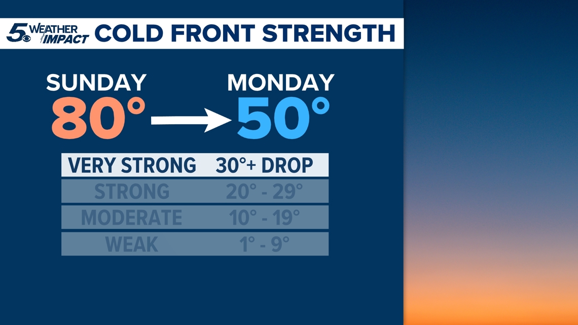
A 40–50 degree drop in “feels like” temperatures is expected from Sunday afternoon into Monday morning. Daytime highs crash from the 80s to the 40s in less than 24 hours marking an arctic cold front.

Forecast
The warm stretch continues through Sunday, then much colder air arrives Sunday night and lasts through Wednesday. Temperatures rebound to near seasonal levels Thursday and Friday.
Wind chills drop into the mid-20s to upper 30s Monday morning, with a freeze possible in some areas Tuesday and Wednesday.

This is a developing weather event. Refresh the page for the latest updates.