San Antonio should avoid severe weather on Wednesday as storms weaken before drifting into the Alamo City.
SAN ANTONIO — Weather Impact Alert Days: Morning of Wednesday, June 3
The reason: Possibility for severe storms, including heavy rain and small hail
The breakdown
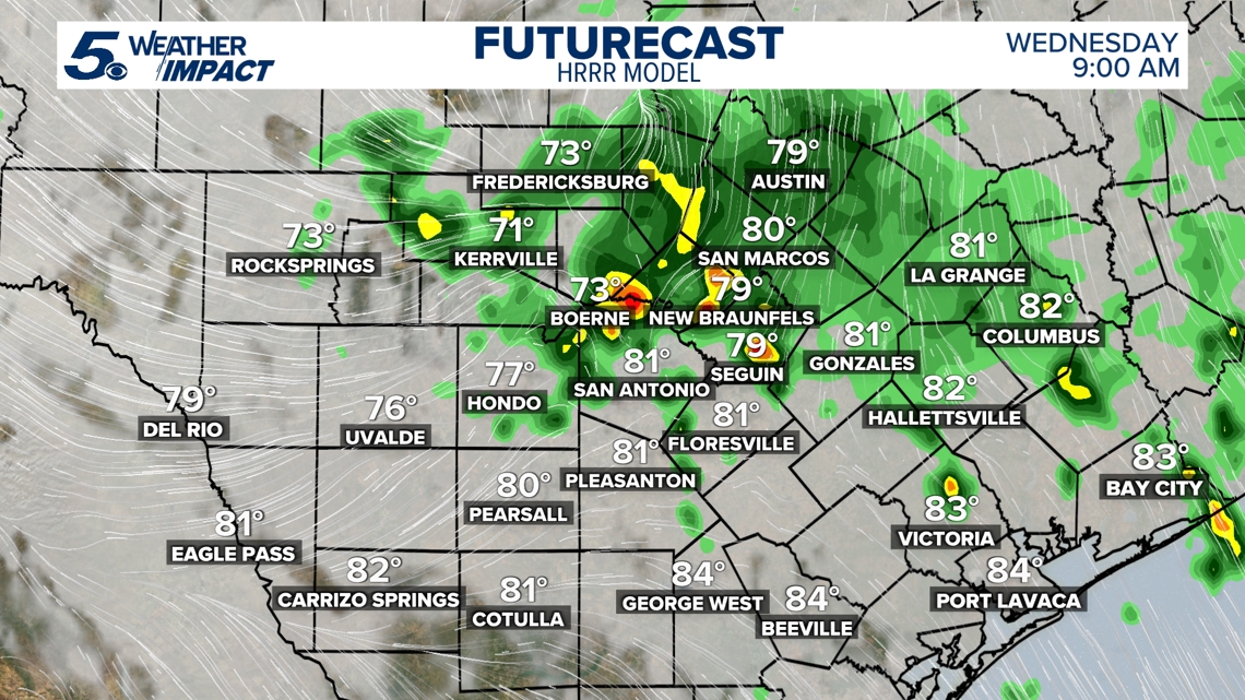
A week after the San Antonio region was drenched by several rounds of heavy showers and storms, another one is coming for the Hill Country on Wednesday morning.
The National Weather Service placed Rocksprings, Kerrville and Fredericksburg in a Level 1 out of 5 risk area for severe weather on Wednesday morning, with a potential for strong winds, downpours and hail. Communities further south – including the entirety of Bexar County – aren’t expected to be hit with severe weather, but might see remnants of the storms in the form of morning showers.
After 9 a.m., rain coverage will trend down quickly, with only spotty activity expected heading into Wednesday afternoon. That being said, localized street flooding and pockets of heavy rain will be possible for the Wednesday morning rush hour—so drive safely and stay in the know on local road conditions!

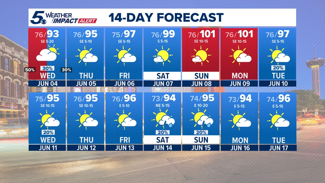
Slim rain chances continue through Thursday morning. High pressure strengthens by Friday and this weekend, boosting our temperatures into triple-digits. Expect daytime highs in the low-100s Saturday, Sunday and Monday, with heat indices closer to 105.

This is a developing weather event. Refresh the page for the latest updates.