The National Weather Service is warning drivers to be wary of residual floods on the road, even as storms exit.
SAN ANTONIO — IMPACT DAYS: Thursday, June 12
Reason: Heavy rain is possible with localized flooding, severe thunderstorms with hail up to the size of quarters and wind gusts up to 60 mph.
The breakdown
Storms swept through the San Antonio region Thursday morning, bringing record amounts of rainfall and deadly flooding to the Alamo City.
Officially, the San Antonio International Airport recorded 6.11 inches of rain, cementing Thursday as the city’s rainiest day since May 2013. While cloudy conditions persist early Thursday evening, the storm hazard has mostly subsided.
However, the National Weather Service says some Flood Warnings remain in effect for bodies of water in the city that remain susceptible to flooding. Those warnings are for:
- San Antonio River near Elemendorf, where moderate flooding is expected. River expected to crest at 45.5 feet very early Friday morning. Flood Warning in place until 6:54 a.m. Saturday.
- Leon Creek at Interstate 35 South, where moderate flooding is expected. River expected to rise to 19.8 feet Thursday afternoon. Flood Warning in place until 1 a.m. Friday.
- Medina River in Somerset, where minor flooding is expected. River expected to crest at 18.1 feet Thursday evening. Flood Warning in place until 7:20 a.m. Friday.
- Medina River at Highway 281, where moderate flooding is expected. River expected to crest at 27.2 Thursday evening. Flood Warning in place until 8:20 pm. Friday.
- Salado Creek at State Loop 13, where major flooding is expected. River expected to crest at 27 feet late Thursday. Flood Warning in place until 12:10 p.m. Friday.
The National Weather Service also said Leon Creek at Loop 410 has risen sharply, more than 13 feet, and has over 41,000 cubic feet of water flowing through it.
CPS Energy crews have continued to make headway outages on businesses and homes impacted by outages, which at one point overnight numbered around 18,000. As of 6:15 p.m. Thursday, that number has fallen to about 1,500. See outage map here.
Though the rain may have stopped, the NWS is warning drivers about residual floods on roads. Remember to turn around if you come across high water.
Day-by-day forecast
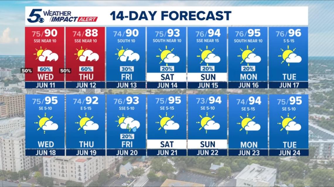
Friday: Low 76, high 93. Small chance of early showers evolves into a chance for thunderstorms after 10 a.m. Partly sunny skies, with wind gusts reaching 20 mph. 30% chance of rain.
Saturday: Low 76, high 94. Partly sunny skies to start the weekend, accompanied by a 20% chance of showers and storms in the afternoon.
Looking ahead…

This is a developing weather event. Refresh the page for the latest updates.