Stay updated with the KENS 5 Weather Team on this severe weather development and how it impacts you.
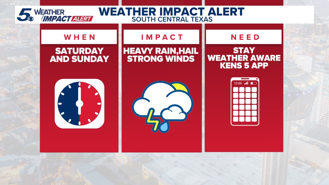
BEXAR COUNTY, Texas — WEATHER IMPACT DAYS: Saturday through Tuesday, March 6-10
Reason: Chances for rain over the next several days as well as storms, some of which could be strong).
Severe Thunderstorm Watch
A severe thunderstorm watch has been issued for Bexar County and several surrounding counties 11 p.m.
The breakdown
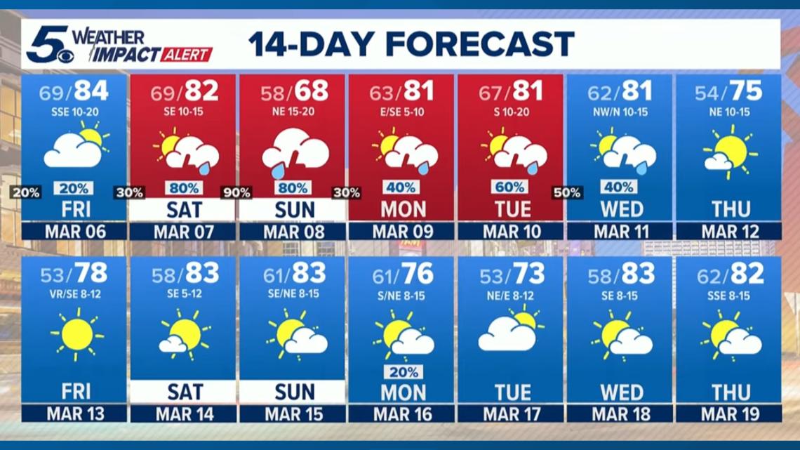
We have chances for rain over the next several days in South-Central Texas. Some areas could see a few inches of rain between now and the middle of next week.
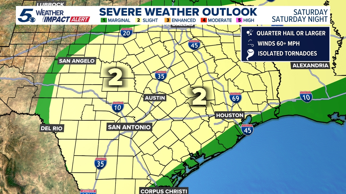
According to the latest forecast from the National Weather Service, the risk for severe weather Friday has shifted north of Austin and out of the greater San Antonio region.
The most severe weather threat of the weekend, however, arrives Saturday. Virtually all of the South-Central Texas region faces a Level 2 out of 5 risk of severe storms.
The biggest threats: Heavy rain, damaging winds and large hail. San Antonio, Boerne, Pleasanton and the Interstate 35 corridor are at a slight risk of excessive rainfall, although the NWS says it’s too early to gauge the potential for flash flooding.


Here’s the chance of Saturday afternoon rain for some of our biggest communities, as of Friday afternoon:
- San Antonio: 80%
- New Braunfels: 80%
- Kerrville: 90%
- Fredericksburg: 90%
- Hondo: 80%
- Karnes City: 60%
- Gonzales: 70%
Looking ahead
There are even more chances for rain Tuesday heading into Wednesday of next week.

This is a developing weather event. Refresh the page for the latest updates.