A tropical system in the Bay of Campeche could bring heavy rain to the Texas coast this weekend, especially in coastal counties south of Houston.
Jaime E. Galvan, Kim Castro, Chita Craft
10:47 AM CDT August 14, 2025
2:29 PM CDT August 14, 2025
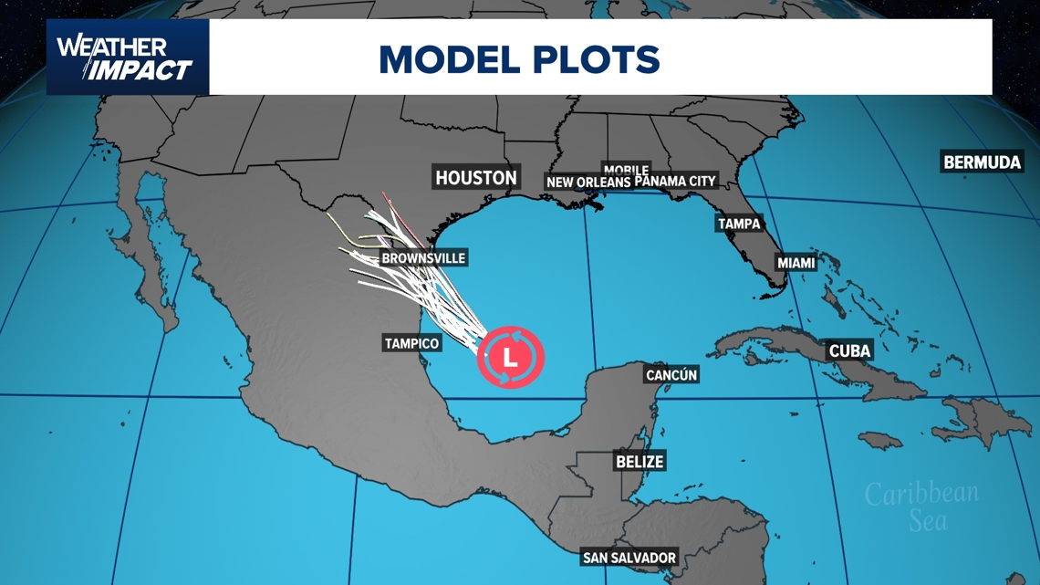
HOUSTON — A broad area of low pressure over the Bay of Campeche is drifting toward the southwestern Gulf, bringing increased rain chances to the Texas coast and northeastern Mexico for Friday and Saturday
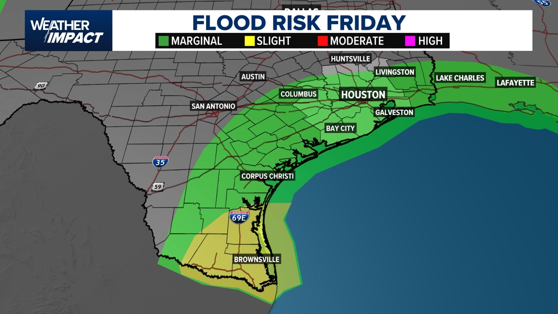
As of 7 p.m. Thursday, the National Hurricane Center gives the system a 50% chance of tropical development over the next 7 days, locally heavy rainfall is possible along portions of southern Texas and northeastern Mexico Friday into Saturday. The Storm Prediction Center has included all of coastal Texas from Corpus Christi to Houston under a Marginal Risk (1 out of 4 scale) for flooding on Friday. Deep south Texas, which includes the Rio Grande Valley will be included in a Slight Risk (2 out of 4 scale) for flooding.

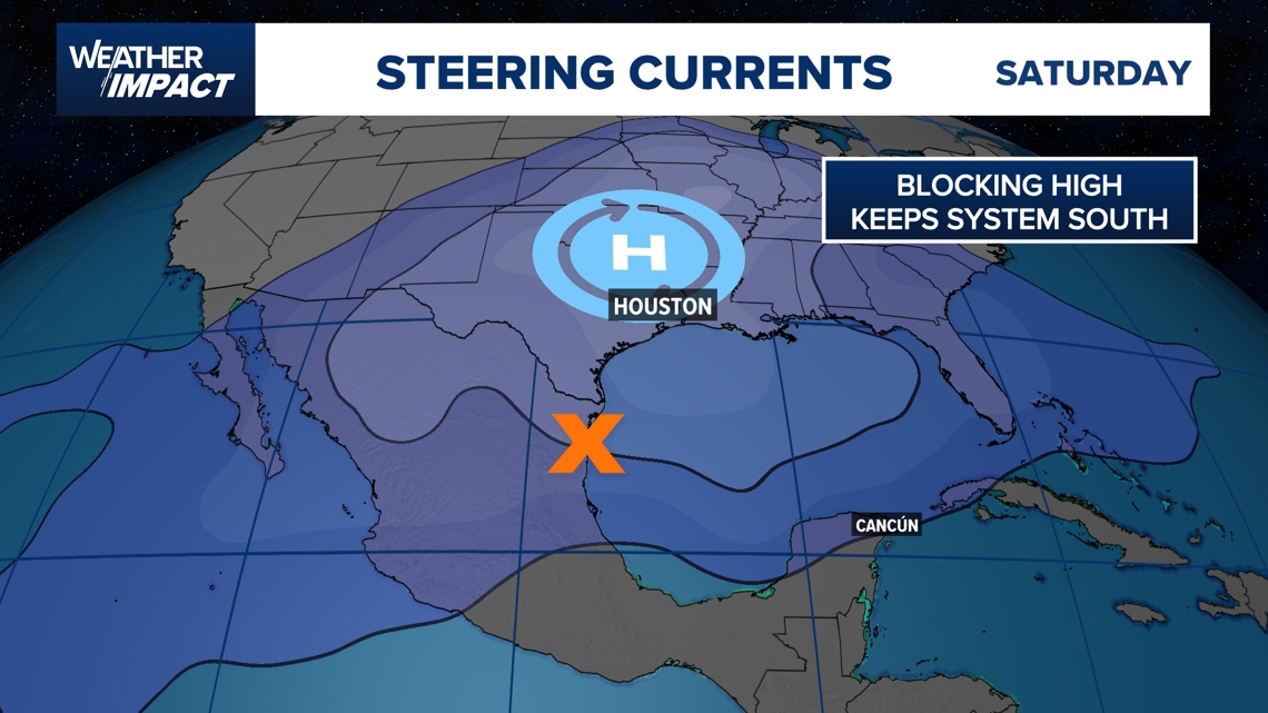
As the disturbance is racing toward land, a building high-pressure system will keep the center of circulation just south of the U.S Mexico border. It is very likely that this system will run out of time to strengthen into a tropical depression as landfall is expected Friday afternoon.

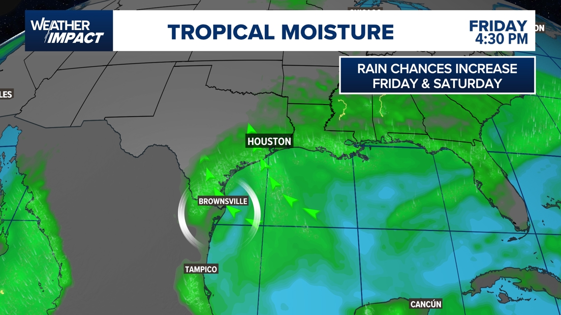
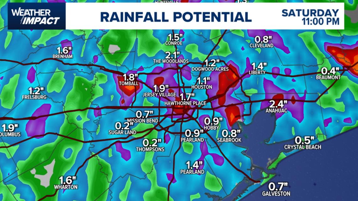
Despite lower chances of tropical development, a surge of tropical moisture will be heading towards the Texas coast and increase rain chances for southeast Texas on Friday and Saturday. Be on the lookout for heavy downpours that could cause localized flooding, and ponding on roadways. Also be cautious on reduced visibility on roadways.

Timing the Impacts
- Friday: Scattered rain and storms expected during the afternoon hours from 12 p.m. through 6 p.m.
- Saturday: Scattered downpours and storms are possible late morning through midday, with activity tapering off by evening.

Areas most affected
- Coastal counties and areas south of Houston could see the highest rainfall totals.
- Inland areas, including Katy, Sugar Land, Jersey Village, Spring, and the Medical Center, may still pick up brief but heavy showers.
- Northeastern Mexico and the Rio Grande Valley face the highest rain risk from the tropical wave.

What you should do
- For Friday commutes: Have rain gear ready; plan for slowdowns during midday downpours.
- For Saturday plans: Morning and midday outdoor events could be impacted by scattered showers.
- Keep an eye on updates if you live in flood-prone or low-lying areas, as tropical moisture can produce localized street flooding.
Looking ahead
Once the tropical wave moves inland late Saturday, rain chances will taper off, with warmer, mostly dry weather returning for the start of next week.