Stay updated with the KENS 5 Weather Team on this severe weather development and how it impacts you.
BEXAR COUNTY, Texas — IMPACT DAYS: Wednesday, April 29, and Friday, May 1.
Reason: Wednesday brings a chance for isolated severe storms, while widespread rain is expected on Friday.
Active weather alerts
- Severe Thunderstorm Watch in effect for Bandera, Edwards, Medina, Zavala, Frio, Kinney, Real, Uvalde, Dimmit, Kerr, Maverick and Val Verde counties until 11 p.m. Wednesday.
The breakdown
Several counties west of San Antonio, stretching to the communities of Langtry and Del Rio, could see severe storms bringing softball-sized hail, 70 mph wind gusts and lots of lightning Wednesday night. The National Weather Service said a Severe Thunderstorm Watch was in effect for the region below until 11 p.m.
Wednesday started out with a marginal risk for severe storms, along with an increasing threat for heavy rain for Thursday night heading into Friday as a cold front moves into South-Central Texas. With the recent rainfall and saturated soils, heavy rains could result in instances of flash flooding towards the end of the week, ahead of an anticipated cold front.
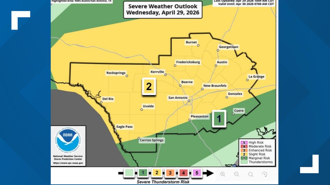
Bexar County, the Hill Country, and other surrounding communities are under a Level 2 out of 5 risk to see severe weather on Wednesday afternoon and evening. Come Thursday, much of the South-Central Texas region will also face a risk of excessive rainfall, per the NWS.
Heat indices are expected to approach the triple-digits Wednesday before another cold front arrives by Thursday. It is expected to clear out by the weekend.
This is a developing weather event. Refresh the page for the latest updates.