The National Weather Service warns of potential flash floods due to expected heavy rain across the Hill Country and I-35 corridor this weekend.
SAN ANTONIO — As search and recovery efforts continue following the deadly Fourth of July floods, the National Weather Service is now warning of the possibility of “locally heavy rainfall” that could spawn flash floods in South-Central Texas, including the Hill Country.
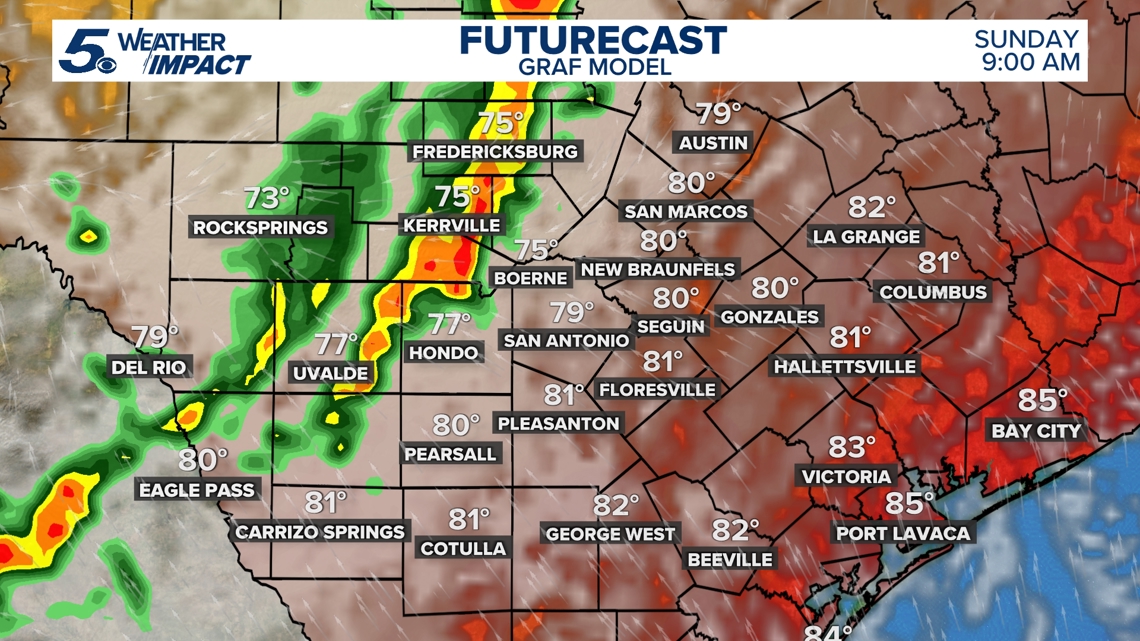
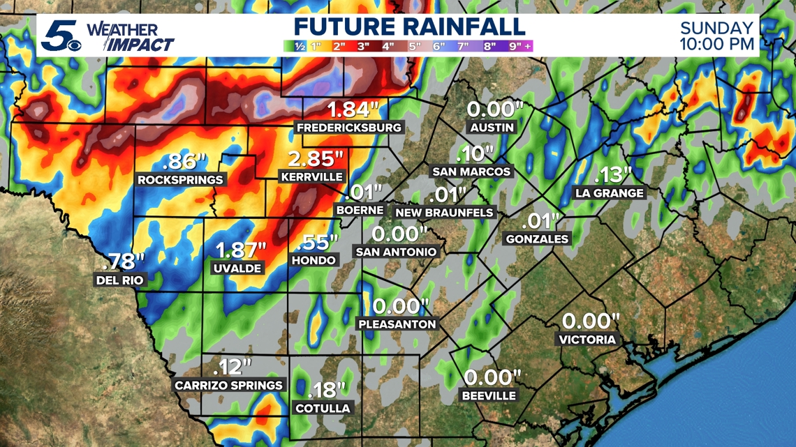
Scattered showers began to pop up in counties northwest of San Antonio around 9:30 p.m. Saturday. That rainfall could intensify Sunday morning, with another round of heavy rainfall possible in the afternoon.
NWS has placed nearly the entirety of Kerr County, as well as parts of Real and Edwards counties, in a Level 3 out of 4 risk of excessive rainfall. Level 3 means there’s at least a 40% chance of flash flooding within 25 miles of the impacted area. Counties to the north, including Gillespie, Kimble, Sutton and Mason, are also in the Level 3 risk area.
“Those living in areas prone to flooding should be prepared to take action should flooding develop,” the NWS said in its latest guidance.
Most of Bexar County is in the Level 2 risk for heavy rain overnight.

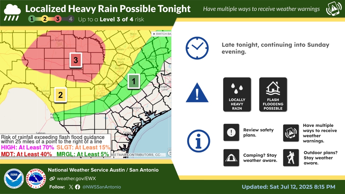
Rapid river rises are also a risk possibility across the Rio Grande, Southern Edwards Plateau and Hill Country.
A Flood Watch remains in effect until 7 p.m. Sunday for most of South-Central Texas, including Bexar County, the Hill Country, the Southern Edwards Plateau and the Interstate 35 corridor.
Communities to our west could see nearly 3 inches by the time it’s all said and done.


The NWS says you should take these three steps to stay safe during a flood:
- Get to higher ground and out of areas subject to flooding
- Don’t drive or walk into flooded areas as it only takes six inches of water to know someone off their feet
- Stay informed by monitoring local radar, television, weather radio, internet or social media for updates
This is a developing weather event. Refresh the page for the latest updates.