You’ll want to pack a jacket this week as temperatures stay winter-like.
SAN ANTONIO — Enjoy the sunshine while you can San Antonians because clouds and rain will make an appearance later this week.
After a chilly start Monday when San Antonians woke up to temperatures in the 30s a nice warm-up in the mid 60s arrived Tuesday.
However, the warmth and sunshine are short-lived the next cold front will bring breezy conditions, multiple days of rain chances, and chilly weather.
Here’s what San Antonians can expect:
Wednesday (High 61 and Low 53): Moisture levels will increase allowing for cloudy skies and rain chances in the morning. This should be light shower activity with morning temperatures in the low 50s. The greatest chance for shower activity will be to the west of San Antonio.
You’ll want to pack a jacket as temperatures won’t rise too much with cloudy skies.
Thursday (High 63 and Low 52): Shower activity should be minimal until evening when a cold front drags through south central Texas. Wind conditions will be breezy near 20 mph. Skies stay cloudy and afternoon temperatures stay in the low 60s.
Rain could pop-up overnight but the greatest chance for showers and storms will be Friday.
Friday (High 59 and Low 52): San Antonians will want to pack their umbrellas as early morning could be slick with the heaviest rainfall to come in the afternoon. One weather model has a line of showers and possible thunderstorms move in around noon. Some isolated downpours could be heavy and come to an end Friday night.

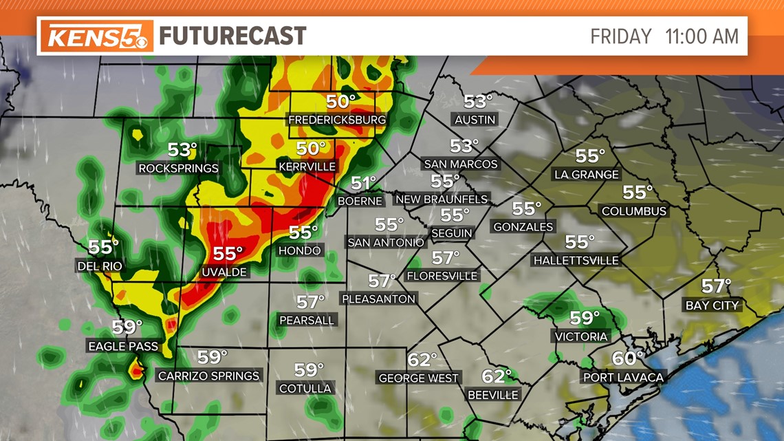
Temperatures stay chilly in the 50s all day.
Weekend (Highs 60s and Lows 40s): Winter weather hangs on with sunshine appearing by the afternoon.
Cooler conditions and a dry pattern will continue through Monday. Overall this will be a great weekend to keep warm with some hot chocolate while enjoying the Christmas lights.
Original News Source
Running For Office? Conservative Campaign Management – Election Day Strategies!