Stay updated with the KENS 5 Weather Team on this severe weather development and how it impacts you.
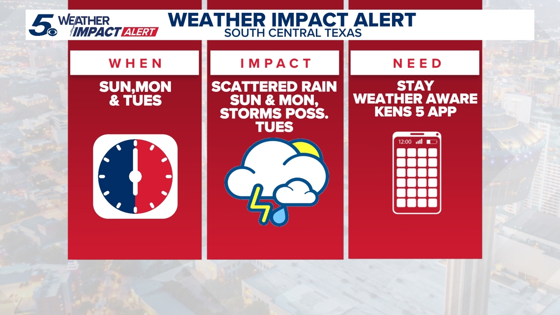
BEXAR COUNTY, Texas — WEATHER IMPACT DAYS: Sunday, March 8 & Tuesday, March 10
Reason: Chances for rain over the next several days as well as storms, some of which could be strong.
The breakdown
Patchy fog and isolated showers are possible Monday morning, with cloudy but dry conditions returning by the afternoon and warm temperatures setting the stage for heavy rain, gusty winds, and hail across South-Central Texas Tuesday and Wednesday.
>>Watch the stream above for the latest radar developments in South-Central Texas.
Rain chances linger into Sunday night with mostly cloudy skies and mild overnight lows in the 60s.
Monday turns warmer and more humid as Gulf moisture returns, pushing highs to back near 80 degrees.
That warmth will help fuel a more active weather setup by Tuesday and Wednesday. Strong to possibly severe storms could develop during that time with heavy rain, gusty winds and hail possible in parts of South-Central Texas.

The timing and exact impacts will become clearer over the next couple days, so it’s a good time to stay weather aware. By Thursday, we will be a lot sunnier. In the meantime, have the umbrella handy on Sunday!
This is a developing weather event. Refresh the page for the latest updates.