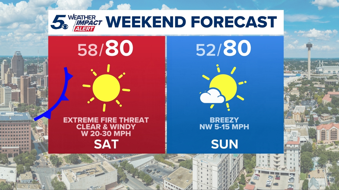
Saturday could see wind gusts up to 40 mph, which elevates our fire threat to extreme this weekend.
SAN ANTONIO — A Red Flag Warning is in effect for a large part of South and Central Texas through 9 p.m. Saturday. The alert includes San Antonio and the Hill Country.
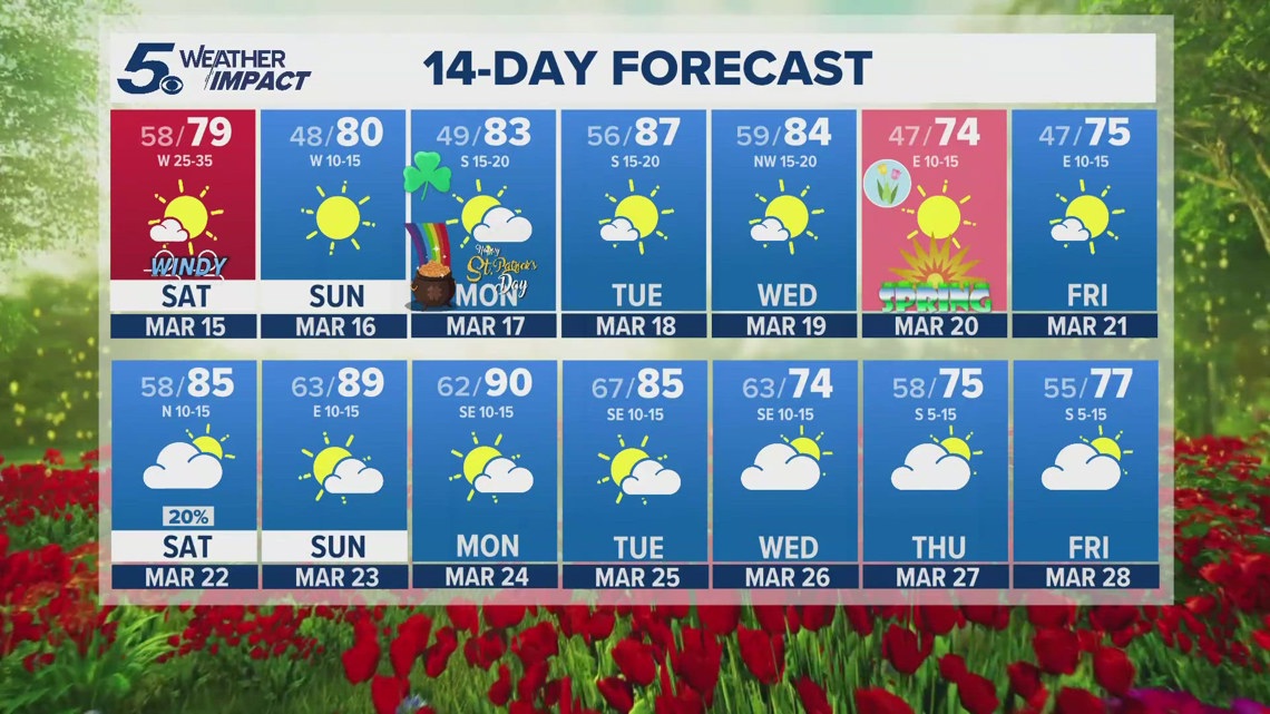
Our typical first 90° day is around April 7 on any given year. This is earlier than usual!
This trend of stronger winds into the weekend will elevate our fire threat to EXTREME on Saturday.
Winds will gust up to 40 mph Saturday afternoon as a front pushes through our area. Keep that in mind if you have any outdoor plans.
Daytime highs will stay in the lower 80s both days this weekend with calmer winds Sunday afternoon. Sunday will be the better half of the weekend!

Aside from warmer than normal temperatures, rain chances remain low in our forecast into the end of March.
According to the National Weather Service, a lack of rain over the last couple of years has led to extreme drought.
Dry vegetation creates a tinder box for wildfires. Embers jump quickly with strong winds, and with extreme drought it doesn’t take much for a wildfire to spread.
Avoid outdoor burning, don’t drive over tall grass, put out unattended fires, and stay up to date on burn bans and daily forecasts to remain in the know about the current fire risk.

These are all things to remember as we head into a warm time of year and winds pick up in the spring season.
Spring officially starts on March 20!