Lightning and sleet were both reported at the same time near Waxahachie, just to the south of Dallas-Fort Worth, on Saturday afternoon.
DALLAS — Our meteorologists are calling for WFAA Weather Alert Days this Friday through Monday. Stay informed by watching regular forecast updates and live radar from across the region on our smart TV streaming app, WFAA+. You can also download the WFAA mobile app for up-to-the-minute alerts from our weather team as they come.
On Saturday afternoon, lightning was spotted in North Texas. Happens all the time, right?
Sure. But, this time, it happened while it was sleeting.
That combination is what meteorologists call “thundersleet.”
Yes, thundersleet is real, and it happens when conditions are right for thunderstorms, but temperatures at the ground are below freezing. And, as you know, it’s well below freezing this weekend in North Texas.
And that’s how it came to happen on Saturday afternoon in Ellis County — just to the south of Dallas-Fort Worth near Waxahachie.
So what is it? Well, perhaps “thundersnow” is a term you have heard. If so, thundersleet is very similar.
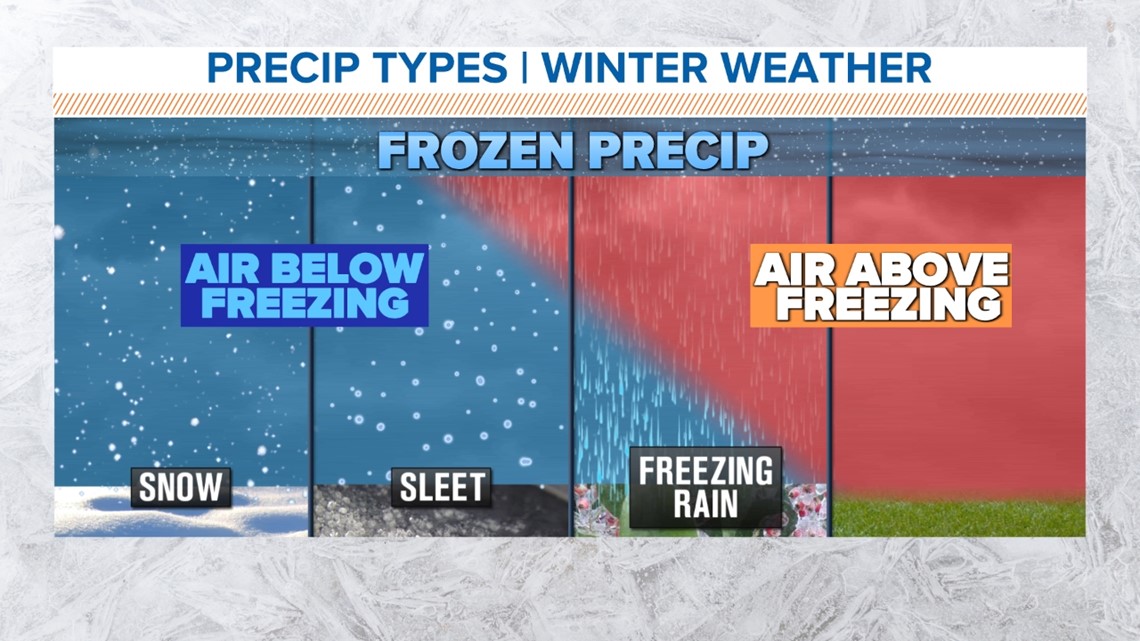
Here’s how it works: Turbulence within a cloud leads to the clashing of ice within it, creating an electrical charge that eventually causes lightning. In a thunderstorm, the ice particles in the cloud fall and melt, creating rain. In a winter weather event, however, as an ice particle falls to the ground, it goes through an elevated layer of warm air, causing it to melt — and then it falls through subfreezing air at the surface. This causes the rain to freeze into little balls forming sleet. If the layer of warm air is thicker, freezing rain forms.
Thundersleet and thundersnow are more rare because of the instability required to create a thunderstorm.