Meteorologist Pat Cavlin breaks down the factors and the timeline.
HOUSTON — It’s been a devastating few days across Texas as the Hill Country and Central Texas dealt with deadly flooding. Many questions remain regarding how this event happened and what the timeline looked like for advanced notice from forecasters.
This flash flooding disaster was an extreme event that resulted from the perfect combination of conditions, timing, and location.
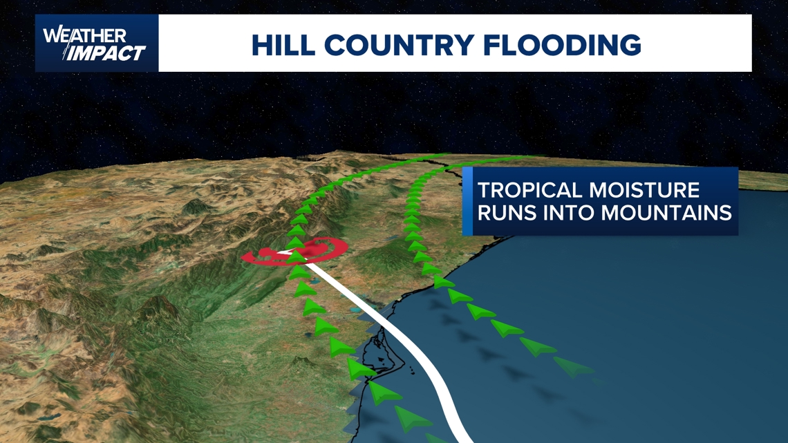
It all started with Tropical Storm Barry, which formed in the Bay of Campeche on June 28. Barry made landfall well south of us in northern Mexico on June 30th.

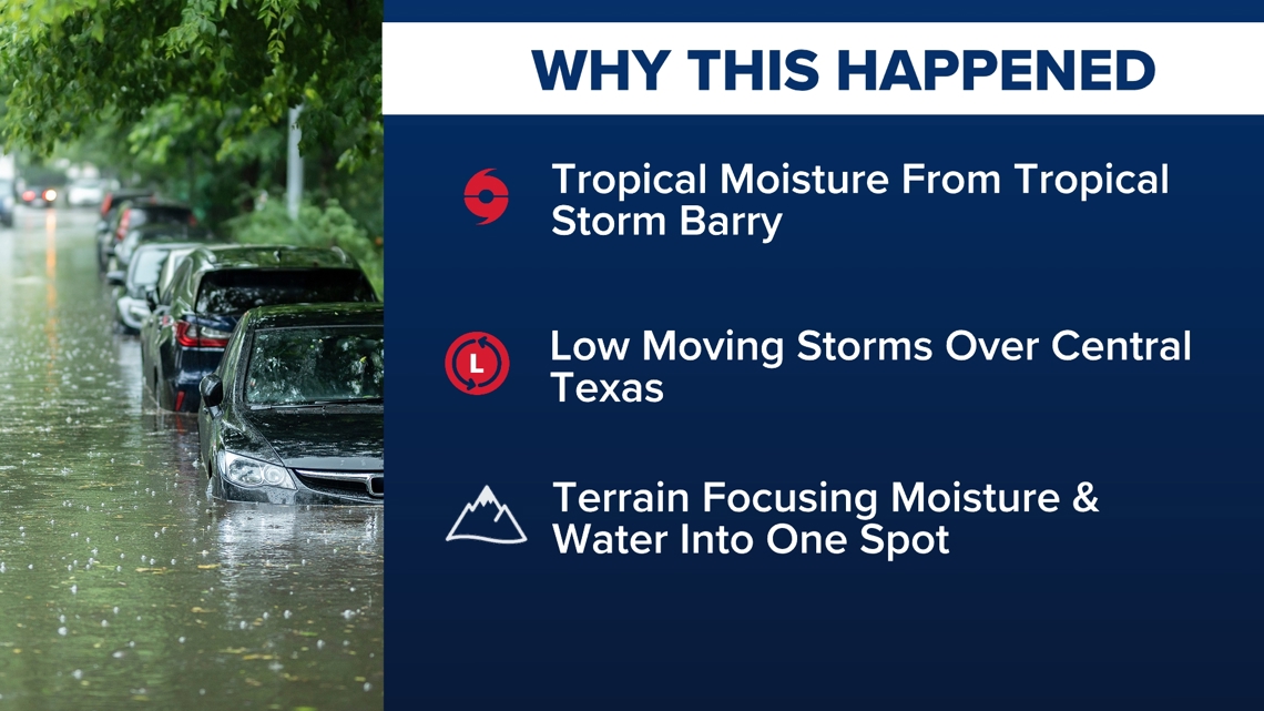
However, even after the storm dissipated, tropical moisture remained in the atmosphere and started to move north to Texas along the Sierra Madre Mountains.

As it did, a compact low-pressure system, known as a Mesoscale Convective Vortex (MCV), became nearly stationary over Central Texas. That provided a trigger for thunderstorms to develop. These storms fed off of the abundant tropical moisture streaming into the state from Mexico.

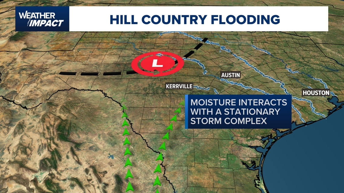
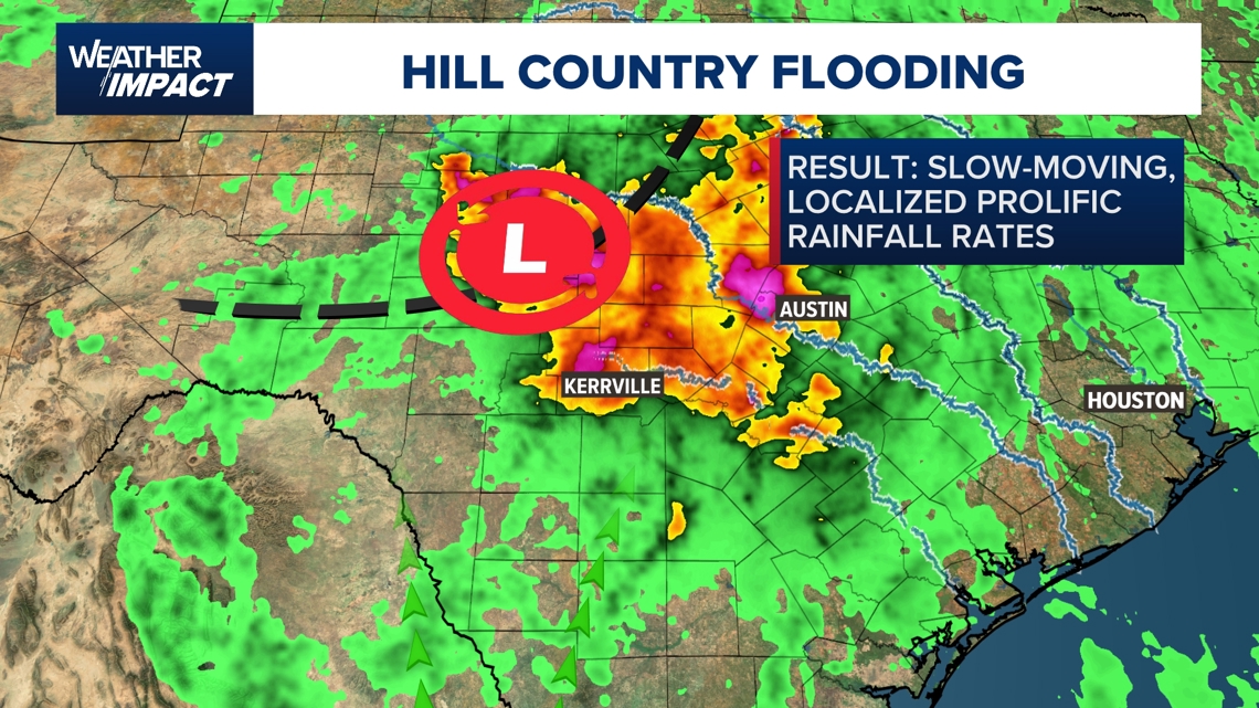
Combine those storms with all of the creeks, ravines and streams that feed into the Guadalupe River and flash flooding developed within minutes.

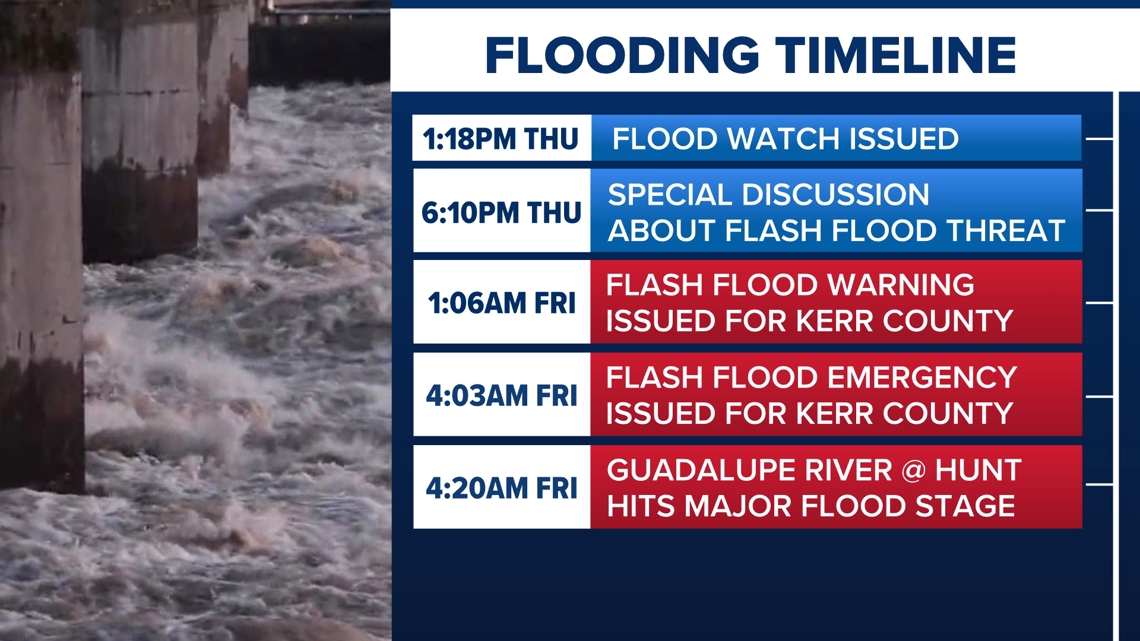
Timeline of flooding

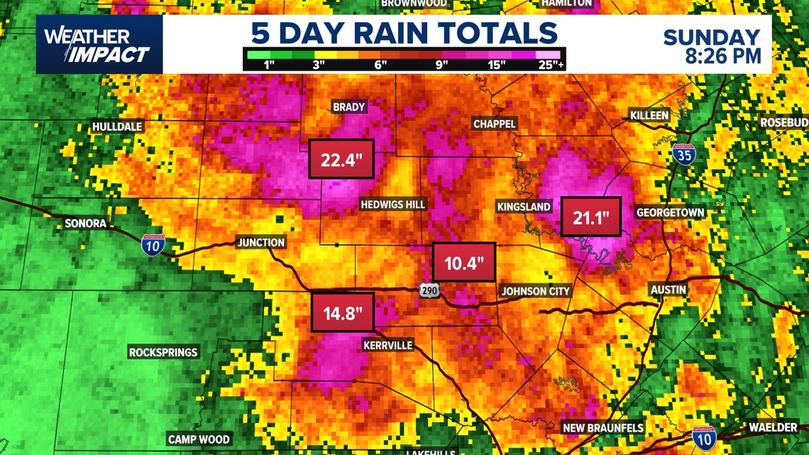
Scale of rainfall
- Over 1 foot of rain fell around Kerrville and Fredericksburg.
- Some areas south of Brady saw nearly 2 feet of rain.
- Training thunderstorms repeatedly dumped rain over the same spots.

Why was it so hard to predict
- Meteorology cannot yet pinpoint exactly where storms will pop up on this small a scale.
- Warnings often come with only 20 to 30 minutes of lead time once storms are detected.
Impact on recovery
- The ground is saturated, so even small additional showers can worsen flooding and hamper rescue operations.
- Some rain was expected to continue, but the worst was over by Sunday.