Stay updated with the KENS 5 Weather Team on this severe weather development and how it impacts you.
BEXAR COUNTY, Texas — IMPACT DAYS: Saturday, Jan. 24 through Tuesday morning, Jan. 27
Reason: Modified arctic air and a chance for freezing rain, with some ice accumulation possible.
The breakdown
An Extreme Cold Warning is in effect from Saturday evening through Monday morning for all of South-Central Texas, including San Antonio. Some areas could see wind chills in the single-digits, mainly in northern Bexar County and the Hill Country.
The National Weather Service (NWS) has also issued a Winter Storm Warning for much of the Texas Hill Country; that will be in effect from 6 a.m. Saturday to noon Sunday for communities north of Bexar County, including Kerrville, Fredericksburg, New Braunfels and Boerne.

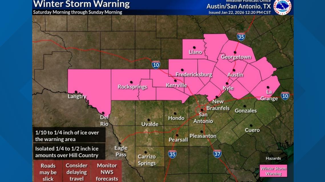
An additional Winter Storm Warning has been put in place for Bexar County and several other counties to the east and south. That warning begins at 6 p.m. Saturday and lasts until noon Sunday.
In San Antonio, temperatures will reach the mid-30s, with wind chills close to 20 degrees on Saturday. We can expect mainly light freezing drizzle/rain and sleet. There is also a chance for less than a half-inch of ice accumulation on elevated surfaces in Bexar County, south of Loop 1604 and along Interstate 10/Highway 90.
On Sunday, more light freezing drizzle is possible in the morning. We’ll stay cloudy as highs reach the upper-30s. Monday and Tuesday will start off very cold with low temperatures in the mid-20s before warming up to the upper-40s/lower-50s.
In the Hill Country, ice accumulation may begin as early as Saturday around noon through the overnight hours. Total accumulation from freezing drizzle/rain and sleet may be as much as a tenth of an inch to a quarter of an inch; that’s enough to cause problems on bridges and elevated surfaces.
Overall, the highest potential for ice accumulation from early Saturday through Sunday focuses on the Hill Country into the I-35 corridor, where there is a 40% to 60% chance of at least a tenth of an inch of ice. Probabilities are lower farther to the south, including San Antonio.
Preparing for the cold
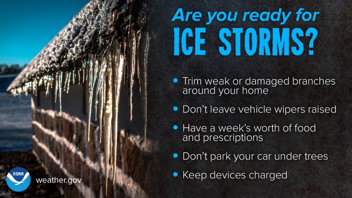
NWS says Texas residents should monitor the forecast frequently as changes are possible and prepare now for winter weather impacts.
The Electric Reliability Council of Texas (ERCOT) says it is monitoring the cold weather approaching the region and will keep Texans informed on grid conditions. ERCOT officials have said the state’s power grid is ready to handle winter weather.
NWS reminds residents extreme cold could become life threatening and likely damage unprotected pipes and put livestock at risk if precautions are not taken. Dress in layers including a hat, face mask and gloves if you must go outside.

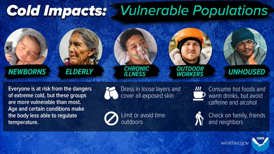

Don’t forget your pets! NWS urges pet owners to make sure to give proper care to our four-legged friends to ensure they have a safe space that is warm and dry during the winter storm.
This is a developing weather event. Refresh the page for the latest updates.