More than two inches of rain has fallen at San Antonio International as of 3 p.m. Friday.
BEXAR COUNTY, Texas —
Active weather alerts
San Antonio conditions
- High-water crossings: Sixteen remain closed in Bexar County at 7:30 p.m. Click for map.
- Power outages: CPS Energy reported the number of customers affected had dropped to about 450 as of 3 p.m., after nearly 7,000 households and businesses were without power at one point overnight. Click for map.
The breakdown
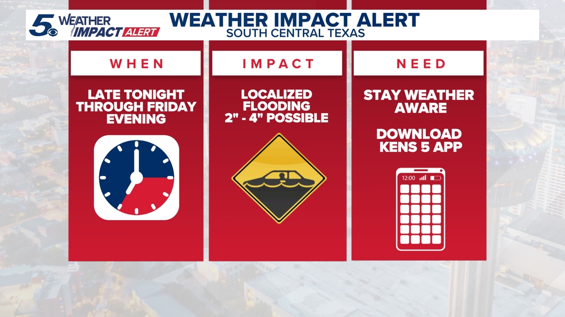
More than two inches of rain have fallen so far at San Antonio International Airport as of 3 p.m. Friday, amid what’s turned out to be one of the wettest days of the year thus far.
A Flash Flood Warning that had been in place for most of the morning for Bexar and surrounding counted has lifted, and a Flood Watch for most of the South-Central Texas region also ended early. It was expected to last until 9 pm.
Multiple waves of rain drenched the region, but largely in the morning. Friday afternoon didn’t bring as many showers as previously expected.
Standing water on low-lying areas and road will remain a hazard. Drivers are urged not to ignore barricades and to find detours if low-lying roadways are flooded.
Isolated pockets of five-plus inches of rain in some San Antonio areas were possible. The rain should clear to the east of the city by 8 p.m. Friday.
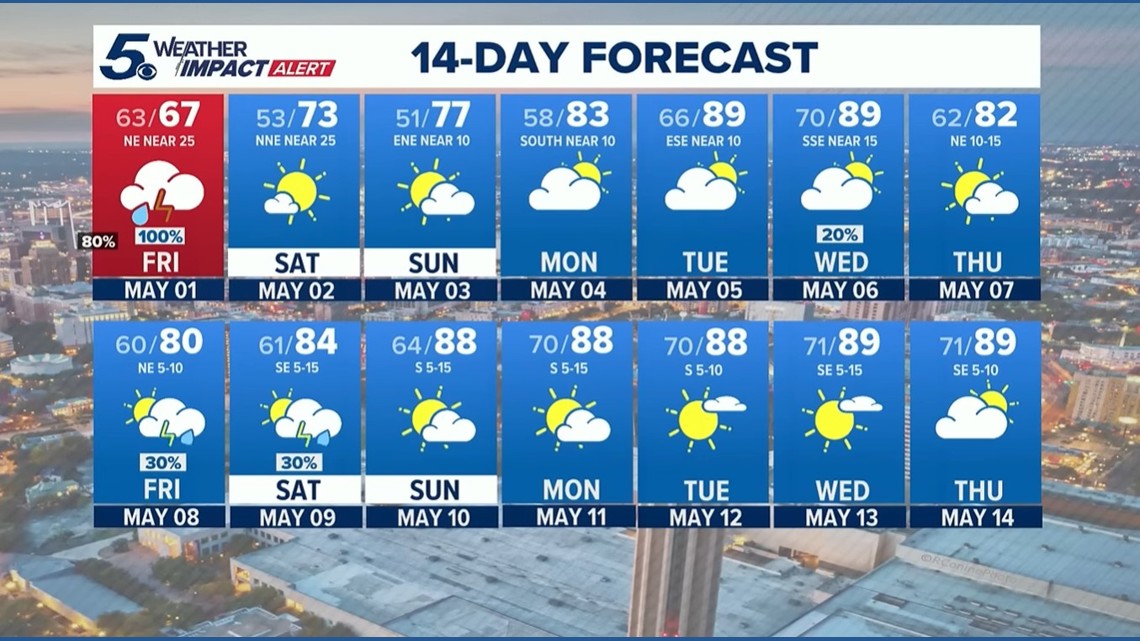
The weekend will bring much cooler and sunnier conditions, along with some wind. If you’re in the Hill Country, you might even see the mercury dip below 50 degrees.
Here is a sample of expected Saturday morning lows across the area:
- Rocksprings: 46 degrees
- Fredericksburg: 47
- Llano: 47
- Kerrville: 48
- Uvalde: 50
- Gonzales: 52
- San Marcos: 51
- New Braunfels: 52
- San Antonio: 53
- Del Rio: 54
- Eagle Pass: 55
Looking ahead
The rain will clear out in time for the rescheduled Siclovia on Sunday. The average high temperature for May in San Antonio is 87 degrees, so we’ll be kicking the month off with unseasonably cool conditions this weekend before the mercury rises back to more typical temperatures.
The next chance of rain arrives midweek.
This is a developing weather event. Refresh the page for the latest updates.