A severe weather system is threatening Texas counties, with the NWS warning of apple-sized hail and possible tornadoes Tuesday evening.
SAN ANTONIO — ACTIVE WEATHER WARNINGS:
Northwestern Kerr, northeastern Edwards and north-central Real counties are under a Severe Thunderstorm Warning until 10:30 p.m. Half-dollar-sized hail and 60 mph wind gusts are possible.
Original story below:
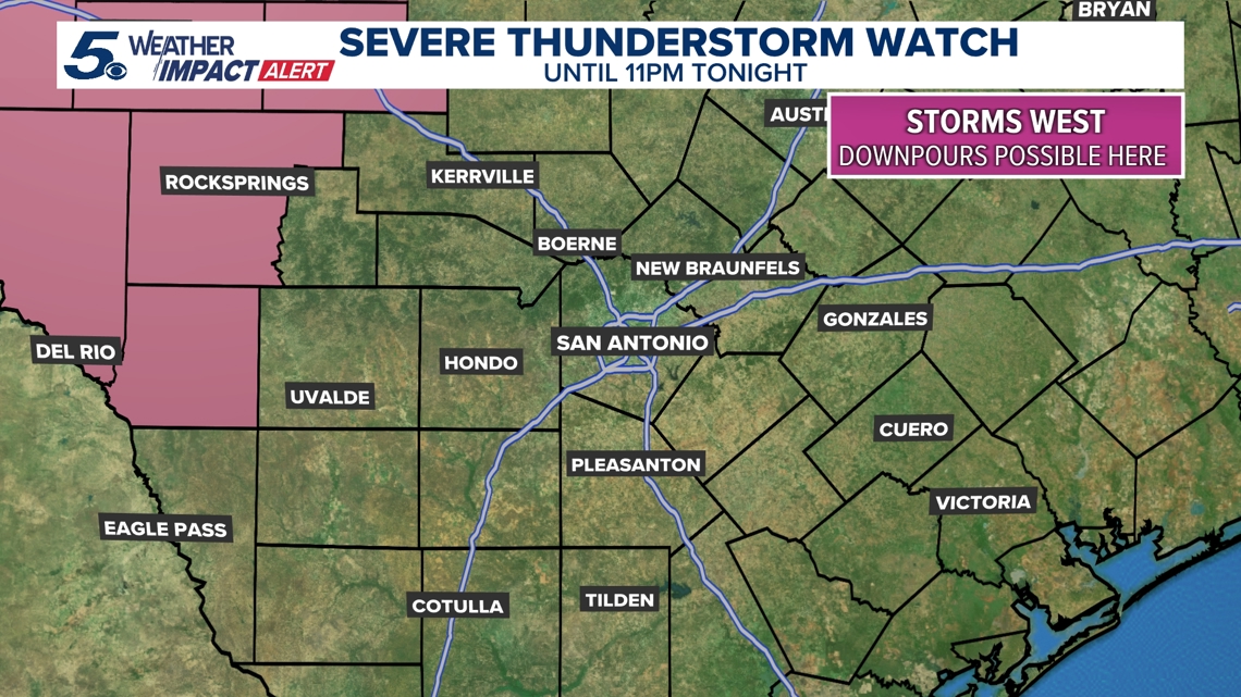
The National Weather Service (NWS) said that Val Verde, Edwards and Kinney counties are under a Severe Thunderstorm Watch for most of Tuesday night as potentially dangerous weather begins to push through.
The impacted area stretches north all the way into the Texas Panhandle, spanning nearly 40 counties in total. According to the NWS, apple-sized hail, wind gusts of up to 70 mph and tornadoes represent the primary threats with this storm.
The watch, which is in effect now, is expected to lift at 11 p.m.
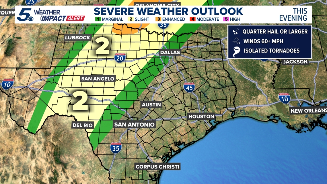
Much of that impacted area is under a Level 2 out of 5 risk for severe weather Tuesday evening. Closer to San Antonio, parts of Bandera, Kerr, Real and Uvalde counties are under a less-severe Level 1 risk.
While San Antonio isn’t expected to see severe weather, the Alamo City could see spotty showers Wednesday morning and afternoon; rain chances are at 30%. Storms could drift into the Hill Country.
After a dry Thursday and Friday, rain chances ramp up with the arrival of a cold front Saturday as the first weekend of Fiesta gets underway.
If you’re in the watch area, make sure to follow these tips to stay safe:
- Have a way to get weather warnings and alerts to your phone
- Stay inside a sturdy building when severe weather is pushing through
- Stay away from windows as severe weather is unfolding
- If roads appear flooded, don’t chance it. Turn around, don’t drown
This is a developing weather event. Refresh the page for the latest updates.